 |
| Tannery museum |
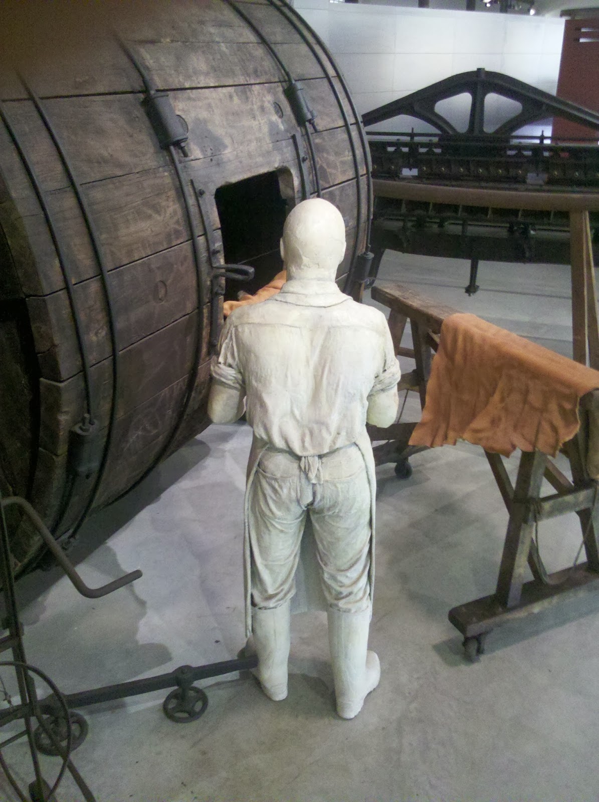
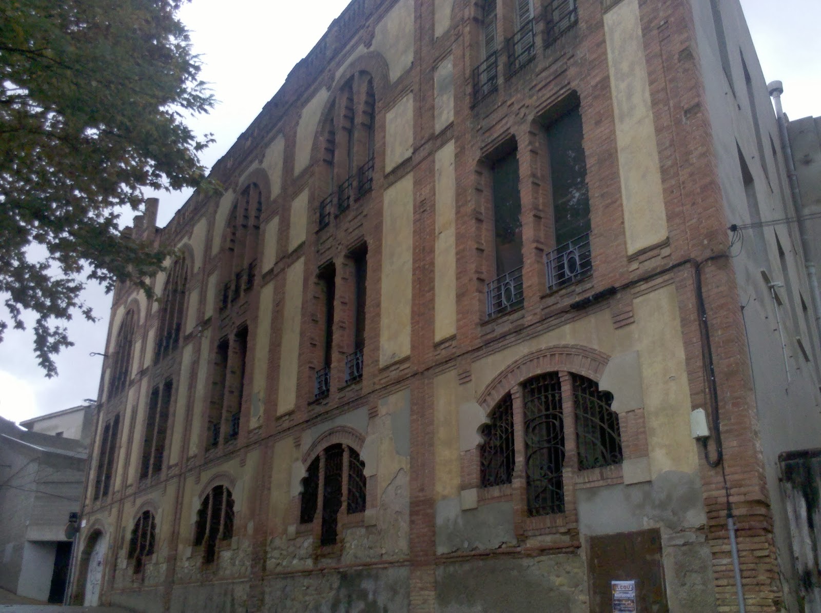
When the two smoking "pilgrims" and their dog finally left the hostel I started to relax and my rest day eventually began for real. I paid another night at the nearby office and set out to visit the town's big museum. It was about leather tanning and I must admit that at first I wasn't exactly very excited about it. But again the place turned out to be a little provincial gem. As it was a rainy morning in off season I was the only visitor and the staff gave me a private tour. Igualada was Spain's biggest producer of tanned leather and even nowadays there are dozens of small tanneries in town. The museum is dedicated to the history of tanning in town and the explanation of the tanning progress. I was glad I had come and spent two hours in the vast complex that is located in an old tannery. And after a walk around town and a nice lunch I spent the rest of the day doing nothing....
 |
| Igualada |
The next day I committed a big mistake. It had already been raining two days straight and the forecast predicted rain for another day. But I had seen everything that there is in Igualada and was itching to leave. Therefore I set off in the rain and hoped the rain would cease during the day. Wrong decision! It was relentlessly raining the whole day drenching me completely. My cheap umbrella broke in the wind and I kicked myself for leaving the nice hostel. But who expects three days of continuous rain in Southern Spain?
Apparently this long rainy period was rather unusual. In Igualada the shops had all put cardboards into their entrances. The posh new tannery museum was "leaking" and the staff to put buckets under several leaky spots in the roof. And when hiking the next days I came across several road blocks because of landslides due to the heavy rain. My rainy hiking day ended with a minor disaster although I had found a great soft campsite and the rain had finally stopped. When cooking my stove toppled over and spilled my dinner all over the ground. This was something I had as always expected but that had never happened. But the French Campingaz canisters have a smaller base than the normal screw top ones and my canister cozy made the whole thing even more unstable. Still I wouldn't be a thruhiker if I hadn't scooped everything up and ate a rather small dinner containing pine needles.

Next day the rain stopped completely and I finally joined the GR 7 close to the little village of Bellprat. I will now follow the GR 7 for the rest of this trip and about 1,700 km. The rain had two bad side effect: the trails and forest roads had been completely flooded and were now covered with huge puddles. This sounds innocent enough but you have to picture the dense vegetation here to see the problem. I was on a stretch with a decent forest road but the huge puddles presented a dilemma. I could either walk through the puddles and get wet feet or try to squeeze past them which meant getting stuck in blackberry bushes or other prickly stuff. Carrying a rather delicate Silnylon backpack made things worse although I only ripped a big hole into my wind jacket. And then I realised with great horror that my maps were gone! I always carry the day's maps in a plastic bag in the pockets of my cargo pants and it dawned on me that they had probably gotten stuck in one of the bushes when I had tried to squeeze past. I deliberated what to do. Hike on without the maps or go back and try to find them. I could have done without the maps for this day but unfortunately I had printed on both sides of the paper and in this case this meant that I would be without maps for two days. I turned around and hoped to find the maps soon but no such luck. Eventually I set myself a stop point and just when I was about to reach it there they were: my little plastic bag with the maps was still dangling from the branches of a blackberry bush. The whole thing had cost me over an hour which did not make me happy with only 10 hours of daylight.

The other rain related problem was the soggy ground. Unfortunately the trail was routed along field edges which means there is no trail - you just walk on the edge of a field. Normally this would be easy because the sun baked ground is rock hard. But now it had turned into a sticky quagmire. I seemed to carry around several pounds of clay with my shoes which looked like they would never ever be clean again. But worse than that sometimes I sank in and had a hard time extracting myself again. Needless to say I looked like a pig out of a mud bath.
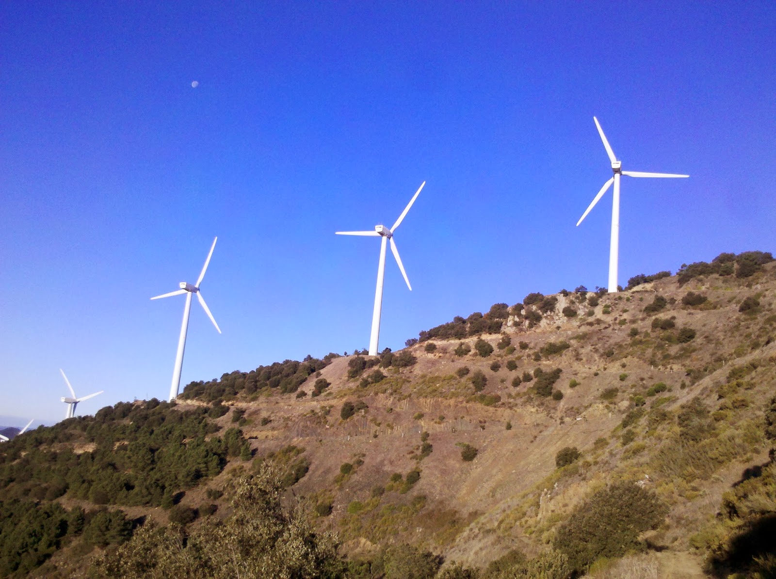
But even when the rain had stopped and the wet ground had dried the weather played tricks on me. Now it was the wind. The temperature was not that warm with 10 Celsius to start with but the strong and ice cold wind made me feel like in Sibiria. Luckily I had bought gloves in Igualada and now I was hiking with almost all my clothes on. Camping became a problem because I had to find a wind sheltered spot. Not always easy and I spent one extremely turbulent night on a ridge. The next day became almost unbearably windy. I had climbed up to the ridge of the Sierra de l'Argentera which has a huge wind farm on top. When I topped out I got nearly blown over. I am not kidding you: I had problems to keep standing and was afraid to be blown off the ridge. Hiking there in these conditions was physically almost impossible.
And of course, as usual when things get difficult the trail marks disappeared.... No way I could get out my maps. Even getting out my GPS from underneath my jacket was almost impossible. I took the first path leading down the ridge and ended up in a labyrinth of overgrown trail and new forest roads - but at least I was out of the ferocious wind.
This is a good time to say something about the trail marking in Spain which can be anything from excellent to non existent - and you'll never know what to expect. Two aspects are especially bad so far: Spanish trail marking focuses on signposts - and neglects blazes. It is infuriating to see a detailed new signpost in the middle of nowhere and 5 minutes later you are lost already because there is no sign or blaze whatsoever at the next junction. The other negative aspect is constructions like roads, train lines and wind farms. They destroy the old trail marking and often pose insurmountable obstacles. I spent several hours around La Riba because all of a sudden there was a new train line that didn't appear on either my paper or GPS maps. No trail marks remained and I was blindly wandering around. Not only are my maps outdated and my GPS track rather vague and inaccurate but the GR's have been vastly rerouted. Every day I encounter several small and big reroutes and I never know where the trail will take me. This fact and the unexpected difficult terrain make safe night hiking difficult or impossible.
 |
| Tivissa |
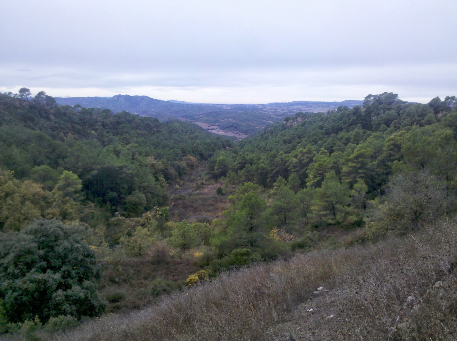
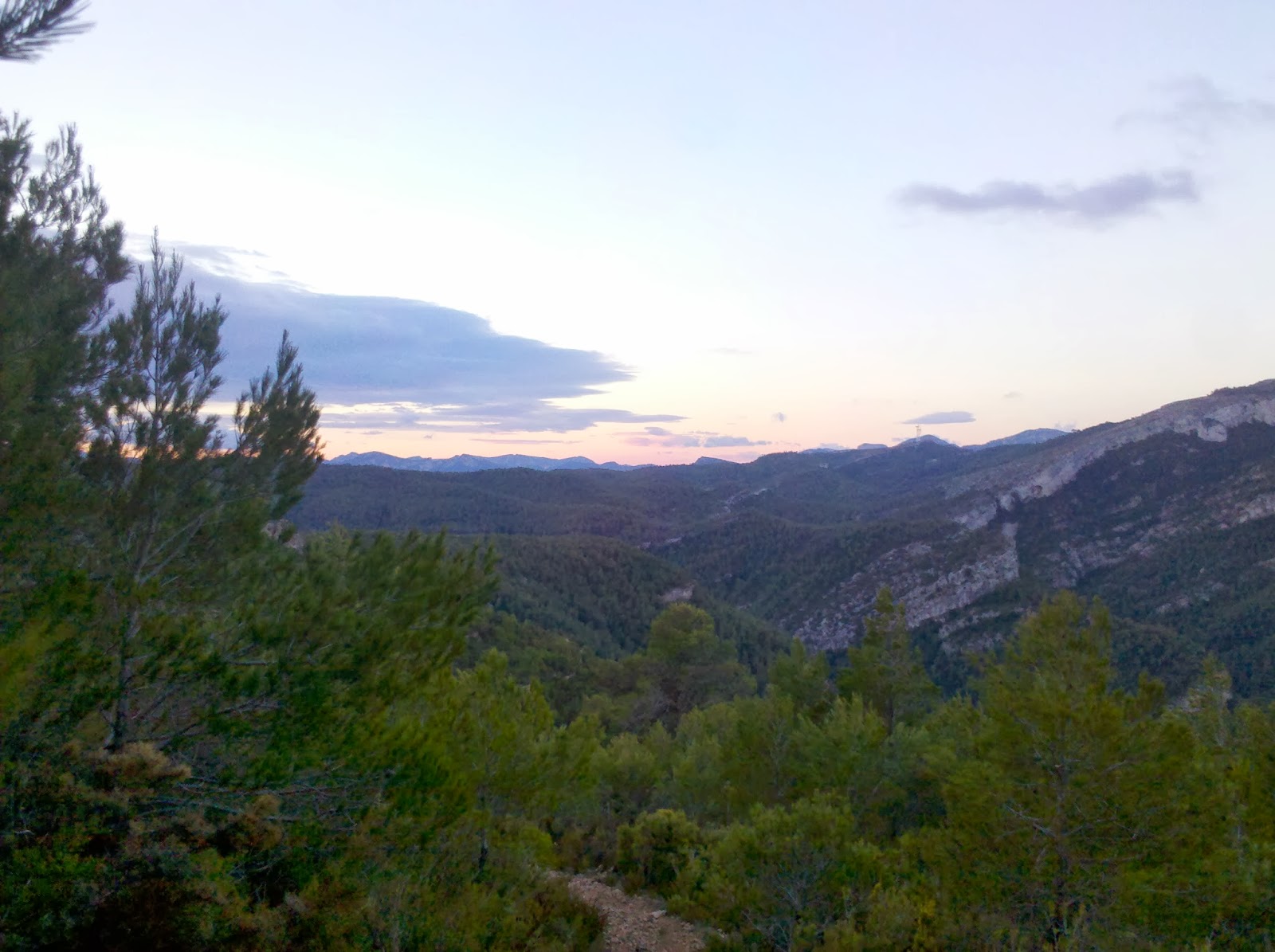
But on the plus side the landscape has been unexpectedly beautiful and downright spectacular. The mesa-like mountains continue and I am traversing one almost unpopulated Sierra after the other on century old rocky tracks. Ruins of long abandoned houses and terraces are the only signs of former human use. Then there is a dramatic river gorge thrown in or some sheer rock cliffs. I had not pictured it so beautiful. The cold and wind have driven me to have two half days off. The town of Tivissa has a campground cum hostel and I could not resist the temptation of central heating and a hot shower for only 15 € per night. The next stretch takes me up to 1,200 metres and the forecast is for 4 Celsius daytime maximum. It's warmer in Germany now...


 Next day the rain stopped completely and I finally joined the GR 7 close to the little village of Bellprat. I will now follow the GR 7 for the rest of this trip and about 1,700 km. The rain had two bad side effect: the trails and forest roads had been completely flooded and were now covered with huge puddles. This sounds innocent enough but you have to picture the dense vegetation here to see the problem. I was on a stretch with a decent forest road but the huge puddles presented a dilemma. I could either walk through the puddles and get wet feet or try to squeeze past them which meant getting stuck in blackberry bushes or other prickly stuff. Carrying a rather delicate Silnylon backpack made things worse although I only ripped a big hole into my wind jacket. And then I realised with great horror that my maps were gone! I always carry the day's maps in a plastic bag in the pockets of my cargo pants and it dawned on me that they had probably gotten stuck in one of the bushes when I had tried to squeeze past. I deliberated what to do. Hike on without the maps or go back and try to find them. I could have done without the maps for this day but unfortunately I had printed on both sides of the paper and in this case this meant that I would be without maps for two days. I turned around and hoped to find the maps soon but no such luck. Eventually I set myself a stop point and just when I was about to reach it there they were: my little plastic bag with the maps was still dangling from the branches of a blackberry bush. The whole thing had cost me over an hour which did not make me happy with only 10 hours of daylight.
 The other rain related problem was the soggy ground. Unfortunately the trail was routed along field edges which means there is no trail - you just walk on the edge of a field. Normally this would be easy because the sun baked ground is rock hard. But now it had turned into a sticky quagmire. I seemed to carry around several pounds of clay with my shoes which looked like they would never ever be clean again. But worse than that sometimes I sank in and had a hard time extracting myself again. Needless to say I looked like a pig out of a mud bath.
 But even when the rain had stopped and the wet ground had dried the weather played tricks on me. Now it was the wind. The temperature was not that warm with 10 Celsius to start with but the strong and ice cold wind made me feel like in Sibiria. Luckily I had bought gloves in Igualada and now I was hiking with almost all my clothes on. Camping became a problem because I had to find a wind sheltered spot. Not always easy and I spent one extremely turbulent night on a ridge. The next day became almost unbearably windy. I had climbed up to the ridge of the Sierra de l'Argentera which has a huge wind farm on top. When I topped out I got nearly blown over. I am not kidding you: I had problems to keep standing and was afraid to be blown off the ridge. Hiking there in these conditions was physically almost impossible.
  This is a good time to say something about the trail marking in Spain which can be anything from excellent to non existent - and you'll never know what to expect. Two aspects are especially bad so far: Spanish trail marking focuses on signposts - and neglects blazes. It is infuriating to see a detailed new signpost in the middle of nowhere and 5 minutes later you are lost already because there is no sign or blaze whatsoever at the next junction. The other negative aspect is constructions like roads, train lines and wind farms. They destroy the old trail marking and often pose insurmountable obstacles. I spent several hours around La Riba because all of a sudden there was a new train line that didn't appear on either my paper or GPS maps. No trail marks remained and I was blindly wandering around. Not only are my maps outdated and my GPS track rather vague and inaccurate but the GR's have been vastly rerouted. Every day I encounter several small and big reroutes and I never know where the trail will take me. This fact and the unexpected difficult terrain make safe night hiking difficult or impossible.
3 comments:
Hi Christine. Keep ahead to the south the weather will be better and the scenery beautiful.
Juan, thanks for the encouraging words. I definitely need some warmer weather, but the scenery is already spectacular.
This is incredibly useful. I'm walking in the opposite direction next week from Alcoy and will be camping mostly. Your experience is great knowledge. Cheers!
Post a Comment