Showing posts with label JoGLE. Show all posts

Thursday, 10 November 2011

John O'Groats to Land's End: Tipps and Tricks

Churches and Cemeteries: When I hiked through Germany I always looked for churches and cemeteries. Why is that? German cemeteries almost always have a free and easily accessible water tap because people have to water the plants and flowers on the graves. And now the bad news for the UK: British cemeteries generally do not have water taps - because they graves are usually just plain tombstones with no plants.... So what about churches? In Germany I used them to recharge my electronic equipment while having lunch outside. In the UK this strategy showed mixed results: In most areas, especially in Scotland and Northern England I found that almost all churches were locked. But when I had almost given up hope I found that many churches on Offa's Dyke Path were extremely hiker friendly! Not only were they open and had electrical outlets, they also offered free tea-making facilities! That is something that should definitely be exported to Germany....

Animals: The UK is definitely a dog country. Nowhere else in the world have I encountered so many dogs.  Usually I am very afraid of dogs and have had some unpleasant experiences with them. But to my big surprise I never had any bad experiences on my JoGLE hike. I hardly ever saw a stray dog - almost all dogs are out with their owners. Although they are still dogs and have selective hearing I was never attacked or even felt threatened. Due to the dog density "No Fouling" signs are ubiquitous - as are they little dog doo doo plastic bags that are now littering the countrysides.... I have mentioned unpleasant cow encounters several times and indeed did I feel very threatened by cattle, especially after having read a magazine article about several hikers who had died in cow attacks. But I want to put this into perspective: All fatal cow attacks were connected with free running dogs. The dog attacks the cow who in turn wanted to protect its calf and went for the dog. Unfortunately, the dog owner then got between the cow and the dog - and got trampled to death. As I was hiking without a dog and trying to give the cows a wide berth I probably never was in any serious danger - although it felt very differently.... I liked sheep best: They always run away from you, do not make much noise and leave very little poo!

Clouds and sea on the SWCP
Weather: This hike proved that what we learnt in our English lessons at school really is true: British are obsessed with their weather! It really is the most favourite topic for small talk and countless times I was greeted with "Lovely day, isn't it?" - even if the whole day has been miserable and the sun had just come out for 2 minutes. Two things really surprised me about British weather: I did not expect such a tremendous difference between the weather up North and down South. Although I was hiking into from summer into fall instead of getting colder it got warmer and warmer because I walked from North to South. Although this can partly be attributed to an unusual weather pattern this year this huge range of climate should be taken into consideration when planning a hike - as should the probability of rain. It seems to rain almost every day and Brits think they are in drought when it has not rained for three days - I am quoting a native here. But the good news is that the rain usually does not last very long: Very often I would hike in sunshine with very little clouds, that became more and more within 15 minutes, then dumped a 4 minutes shower on me only to disappear and let me dry my now wet stuff in brilliant sunshine again. For me wind has been the biggest problem - not rain.

TT Rainbow in the Scottish Highlands
Equipment: I do not want to go through my whole gear list here - I was carrying pretty much what I am usually using on a long hiking trail. But I want to point out two pieces of equipment that posed a certain problem for me but worked out extremely well in the end. The first item was the tent: My default tent was a Tarptent Contrail but this has proved to be not very wind stable on my last trips. As I knew that I would be camping in very exposed terrain most of the time I had to bring something more robust and therefore I decided on a Tarptent Rainbow - which was even donated to me! And this tent worked out remarkably well. Only slightly heavier than the Contrail it was even roomier, very easy to set up and worked resisted the wind pretty good. It still is not a Hilleberg expedition tent, but is a very good compromise  between weight and stability. I will definitely take it again on a similar trip. The next concern was my sleeping bag. Although I had always used down bags before I realised that this would be a trip in very damp conditions with little opportunity to dry stuff in the sun. As down's warming capacity deteriorates rapidly when damp I decided to bring the BPL synthetic quilt. It worked surprisingly well, too: When temperatures dropped below zero Celsius I was still pretty warm in it - although I had to wear all my clothes. But still: it fared much better than expected and will probably become my standard bag from now on.

Friday, 4 November 2011

John O'Groats to Land's End: Conclusion

As you might have guessed from my previous posts this hike has not been my most favourite hike. To tell the truth it has probably been the worst hike I have done since I have started this blog. But still: If you asked me if I would recommend this hike to a friend I would not say "No". I would just say that there are better hikes out there. So why has this hike been such an unpleasant experience? There are various factors that in combination with each other turned this hike into a miserable trip. Some of them are just bad luck, some are my own mistakes, but most of all I came to the conclusion that the UK is not the greatest country for long-distance hiking:

Bad luck: I started August 11th and finished October 23rd. Right from the beginning of my trip all the way to the end of September I have had bad weather. Not disastrous weather like the torrential rain I had experienced on the Florida Trail or in Australia, just colder and windier than usual weather. I had frost on my tent on August 25th!!! The constant strong wind made hiking cold and miserable and camping challenging. Bad weather can happen on any trip but in the UK it has a much higher impact on the quality of your hike than in other countries. And unfortunately, Scotland and Northern England were experiencing a very cold and rainy summer this year. End of September the weather changed all of a sudden and I was rewarded with an unexpected glorious Indian summer. But unfortunately by that time I had already been so ground down that the good weather could not boost my morale any more.

My own mistakes: For JoGLE I had used the same sort of map / guidebook setup like on my hike through Germany a couple of months earlier. I had the whole route as a track on my GPS. The GPS had only basic maps, in this case Open Street Maps. I carried guidebooks with strip maps for the marked official trails and print outs for the stretches between them. On top of all that I carried an overall guidebook for the whole route by Cicerone - something that was not available for my German hike. This set up had worked extremely well for my hike in Germany, but was absolutely insufficient for JoGLE. Why is that? Well, in Germany there was not much need to find alternate routes due to bad weather. Also German trails are very well marked. Even if you do not have great maps, you will get there by just following the trail markers. The situation in the UK is very different: Gale force winds and driving rain very often made me want to change to a lower or less exposed route - but unfortunately alternative routes were not covered by my strip maps or print outs and my basic GPS maps were too unreliable and not detailed enough for creating alternates. Following established trails was not an option either: There are far less waymarked trails in the UK than in Germany and even if there was an established trail the waymarking is usually so bad that you will get lost without a detailed map.

Stile
A second mistake has been to trust the Cicerone guidebook. Although the route given in there, the list of trail town amenities and the sketch maps were pretty good and accurate, the break down into daily stages led to several problems. The author gives 2 schedules for JoGLE: 2 months or 3 months. I had always considered myself to be an experienced hiker and therefore believed I could easily do the hike in 2 months. I planned my resupply accordingly and set off with 9 days worth of food for the first 8 day stretch - and ended up with almost no food left in the middle of the Scottish Highlands because I physically could not hike the daily mileage. I only escaped starvation by detouring to Ullapool with the map another hiker had given me. Even in hindsight it is still a mystery to me how the author can suggest a daily mileage of 40 km and more in challenging terrain like the pathless Scottish Highlands, demanding  Offa's Dyke Path or the steep South West Coast Path. I was falling more and more behind schedule and getting more and more frustrated by it.

UK is not a good country for long-distance hiking: Keep in mind that I am writing this paragraph just with respect to long-distance hiking, e.g. month long camping treks. What is tolerable for shorter trips becomes a big problem if you have to deal with day after day after day! And some problems do not arise if you are not camping but using hostels and or B&B. What made me arrive at my "not suitable" verdict?
  • No forest: As I have pointed out in earlier posts, only 5% of the UK is forested as opposed to 30% of Germany. And this leads to a serious problem for long-distance hikers: There is no shelter from the inclement weather. You are almost always directly exposed to the wind and rain. This can make hiking miserable and camping almost impossible. If you are able to find a rare patch of forest it will be fenced in and most probably completely overgrown. 
  • Bad waymarking: There are not many fully waymarked long-distance trails. Of course there are thousands of public footpaths, but finding your way on them can be challenging. Because there are no trees, blazes on trees that are used in Germany will not be found in the UK. Instead you will see signpost showing you the general direction - and then you are on your own finding your way across huge pastures full of aggressive cattle or mud pools. If you are lucky you will find foot paths signs on stiles and gates, but again they will only show the general direction. Even with a good map and/or a GPS navigation is difficult and time consuming. 
  • Difficult terrain: The combination of cattle, a lot of rain and no forest turns a huge part of British trails into one huge mud pool. Especially notorious are cattle gates: Because there is a lot of animal movement the area around them is generally one big dirt pool. But of course the gates are usually locked and you can only open it by stepping right into the deepest part of the dirt pool - yuk! Although you would assume that there aren't many steep climbs and descents because the UK does not have any high mountains. Wrong! Whenever there is a hill the trail climbs straight up the steepest slope only to drop straight down again immediately. It seemed to me that they tried to make the hills as difficult as possible in order to disguise the fact that there are no mountains. Also: Switchbacks do neither exist in British vocabulary nor on trails....
Can you spot the stile?
  • Stiles and gates: It is not a great problem to climb a stile once in a while, but if you have to climb one every 10 minutes it starts to get annoying. I encountered the highest density of stiles on Offa's Dyke with up to 80 stiles in 20 km!!!! And of course most of them are not exactly easy: I encountered loads of half or completely broken stiles, slippery rock stiles and stiles completely overgrown with stinging nettles and/or thorny blackberry bushes. 
All those factors lead to a dramatic drop of my daily mileage. I usually hike around 36 km per day, whereas I was happy to cover 30 km on my JoGLE hike. The only stretches were I could actually just hike without spending hours on navigation, climbing stiles and mastering mud pools were on canal tow paths or rail trails. 

To sum it up: I think there is much better and easier long-distance hiking in other countries than the UK. If you do not want to specifically hike in the UK for whatever reason, I would just recommend hiking somewhere else. If you insist on hiking in the UK be prepared for a low daily mileage and lots of rest days due to bad weather. Carry good rain gear and bring detailed maps for the whole trail. If I was to hike in the UK again I would chose a route along towpaths and rail trails - or cycle John O'Groats to Land's End instead of hiking it. But if you are just looking for a 1 or 2 week hiking holiday the UK offers some really unique and beautiful trails like the Pennine Way, Offa's Dyke Path or the South West Coast Path. 

Wednesday, 2 November 2011

John O'Groats to Land's End: South West Coast Path

Walking towards Westward Ho!
I joined the South West Coast at Barnstaple still without a South West Coast Path guidebook. I had not been able to get the one I wanted in Bristol or any other town along my route. So I really pushed hard to make it to Barnstaple before shop closing time. I had even decided to reward myself with a stay in a B&B there. I reached the Visitor Information just 15 minutes before closing time on a normal weekday in October and asked them to book me into a nice B&B - only to find out that everything was fully booked! This was the one and only time I wanted to splurge - and then I cannot find accommodation.... I had to walk back for about 3 km to the last possible campsite I had passed without having indulged in a shower, laundry or other luxuries of civilisation. At least I had been able to purchase a guidebook 5 minutes before the book shop closed and was now able to plan the last days of my hike.

I must admit that I felt really tired and worn out by then. I had only about one week left to go but it seemed like an eternity. I just wanted this hike to be over - a feeling that I had not had before very often. I still wanted to finish but if I did not want to hate this hike I had to take it easy - and that is difficult on the SWCP that has constant steep climbs and descents. Therefore I made 2 decisions: Stay in hostels wherever possible to avoid camping in gale force wind and short cut the SWCP by flat road walking when quite country lanes offer an easy alternative. My first hostel stay on the SWCP was Westward Ho! This little town is really spelt like that - including the exclamation mark! The hostel was fantastic and I even had the whole dormitory for myself - an experience that should repeat itself in the two other hostels Boscastle and Perranporth. This was low season and hardly anyone else around except for the weekends when sometimes the whole hostel gets rented out.  The road walking was just a short experience: First of all because there were not too many feasible quiet country lanes, but mainly because I realised that the coast was really spectacular and even worth the constant ups and downs.

The terrain on the SWCP varies from walking on sand beaches to rocky cliff top walking and is truly spectacular most of the time. As an added bonus there is lots of evidence of former tin mining. There are mine shafts and ruins of former industrial buildings. You can even visit a former tin mine which is right on trail - but I must admit that I could not be bothered to see it. On average I had 1.500 meters of ascent every day and that does not put you in sightseeing mood. At least the weather was behaving itself during this last week. Camping became my biggest problem: There was no shelter from the wind on the exposed cliff tops and the only chance of finding a decent campsite was in the small valleys or by venturing a bit off trail into a little patch of forest. It was difficult to tell from the map what the ground would be like but I was usually lucky and found a halfway decent spot.

Eventually the end of my hike came into sight. I was counting down the days and hours and still feel a bit guilty about it. The SWCP is truly beautiful but I was not in the mood to enjoy it much. After a while all the rugged headlands and beautiful beaches looked pretty much the same to me. Most of all I was constantly worried about the weather changing. My hike had taken longer than expected and I was well into the second half of October. How long would this good spell last? Well, it lasted until my very last day on my thruhike - I was very lucky.


The End at Land's End
I finished on October 24th at Land's End in gale force wind that made walking difficult and even scared the tourists at this well visited tourist spot. It is so touristy that the famous "Land's End signpost" is owned by a professional photographer who does not allow individuals to take pictures of it with their own camera - you have to pay for that privilege.  I dutifully took some finish pictures, signed the John O'Groats to Land's End register, had a look into the gift shop and waited for the bus to take me to Penzance. My hike was finally over - thank God.

John O'Groats to Land's End: Offa's Dyke to South West Coast Path

M4 road bridge

The stretch between Chepstow at the end of Offa's Dyke and Bristol is pretty much a hiker's nightmare. First of all you have to cross the Severn River and the only way to day that beside swimming is the M4 motorway bridge. This bridge is 4 km long, is fully exposed to the elements and has 4 lanes of fast traffic on it. The only good news is that there is a separate bike lane that can be used for hiking and that I had exceptionally good weather on that day meaning that I did not get blown off. Once off the motorway bridge you meander around pastures and fields until you hit the suburbs of Bristol.

Bristol
It would have been a very long day without any good camping options if I had not planned a couchsurfing rest day in Bristol to break up this long stretch through urban areas. It came as a very positive surprise that my couchsurfing hosts almost lived on my route through the outskirts of Bristol! Phil and Sheila are very experienced couchsurfing hosts and guests and had a lot of interesting couchsurfing stories to tell. They have even couchsurfed in India - which has put some interesting ideas into my mind. As usual time was too short: So many stories to share and a lot of sightseeing to do. Bristol came as a very positive surprise, too: I had expected a rather ugly city with no sights and was surprised to find a vibrant city with plenty to see - I spent half a day in the newly opened Bristol Museum.

Dyke
Then I set off to tackle the second stretch of urban hiking through the outskirts of Bristol this time crossing the River Avon on the M5 motorway bridge. When I finally reached more rural areas I had to  mostly hike along dykes. This was all very low-lying country and instead of using fences pastures were divided by dykes. I had found a nice patch of forest on the map for camping but when I got there I had to realise that it was completely surrounded by a dyke - no way whatsoever to get in. It was totally overgrown anyways. What now? I did not really want to camp with all those curious cows... but luckily I found a nice patch next to a footpath - separated from the cows only by a dyke. 

Sunrise over Exmoor
Things got really bad when I reached Exmoor National Park. I have had decent weather for over 2 weeks by then but of course the one day I had to hike across moorland the weather turned bad. It rained the whole day and I was soaking wet. My morale reached a very low point when I met 2 farmers tending to their sheep and they told me: "We wondered wether we should go and work in this miserable weather, but you are even hiking in it?...." I should have just taken the next possible campsite then and had a half rest day. Instead I hiked on trusting my guidebook that promised campsites further along the River Exe. 2 hours later and even wetter than before I had reached Exe Head with not a single feasible campsite in sight. I looked around for almost an hour I could not find the tiniest piece of ground that would not bubble up water as soon as I stepped onto it. As light was fading I started to get desperate. I saw a tiny bit of forest but that was very close to a farm house. I did not dare to camp there without asking for permission - and usually I do not camp that close to civilisation. But this was one of the rare cases when I did not have a choice. I walked up to the farmhouse, knocked and yelled but nobody answered. I tried the door and it was open. I could have stolen the whole household as nobody was there but the house was clearly inhabited. So what to do now? I walked around a bit and then luckily the farmers showed up clearly surprised to find a totally drenched, slightly incoherent hiker at their doorstep - but they did not have any objections to my camping plans. And this being the UK I was immediately invited to a cup of tea. 2 hours later I emerged back into my tent after several cups of tea, half a dozen eggs, my clothes dried in their boiler room and loads of knowledge about farming in the UK. I had quizzed them with hundreds of questions and it had been especially interesting for me to compare my Australian agricultural  knowledge with the UK.

Sunday, 30 October 2011

John O'Groats to Land's End: Offa's Dyke Path

Chirk Castle
I wanted to join Offa's Dyke Path as far north as possible in order to be able to see the 2 National Trust castles along the trail: Chirk and Powis. But unfortunately between me and Chirk Castle was the totally unmaintained Maelor Way - and Chirk Castle closed at 5 pm! I decided to roadwalk to get there in time for some sightseeing. I arrived at 4 pm only to learn that I had to walk half a mile around the whole place just in order to get my free National Trust member ticket. By 4.15 pm I was completely pissed off with the whole castle idea, but at least in the possession of a ticket. But 45 minutes proved to be enough for the castle - although impressive from the outside there was not that much to see inside.

Once on Offa's Dyke Path I realised that I had run into a positive problem: Good weather! I could not believe it, but now - already towards the end of my hike when I had completely given up hope that the weather would ever improve - an incredibly warm Indian summer had begun. On October 1st temperatures nearly reached 30 degrees Celsius - after I had had frost on my tent in Scotland on August 25th! Day after day after day sunshine! I started hiking in shorts and a T-shirt and nearly got a sunburn. Now you wonder why all that is a problem. Well, I wanted to as much advantage of the good weather as possible and lose not a single day of sunshine for a rest day. I even skipped Powis Castle in order to hike on and on and on - and ended up hiking 2 weeks without a rest day. After all that bad weather I had not expected that the weather would stay that nice for so long. But I did not only need a rest, I most definitely needed a shower and laundry. I started to smell really bad even for thruhiker standards. I washed up in a lot of rivers and hand washed one piece of clothing at a time so I could dry it a the back of backpack while hiking. On my second last day on Offa's Dyke I got to Monmoth were I discovered a camp ground with a coin-operated shower. I could not believe my luck but had to realise then that I did not have a 20 pence coin needed to operate the shower. I went off to get change. The first person I asked did not have enough small change but gave me 20 pence. "Don't worry," she said. "I just want you to have a shower." I guess I must have smelled really bad....

Offa's Dyke offered a lot of hiker amenities: Lots of the churches were open to hikers and offered tea making facilities and sometimes even free biscuits or juices. Free food was available in the form of huge apple orchards, the occasional plum tree and loads of blackberries. And to my great relief the waymarking was excellent. Still hiking was not easy: The trail follows a dyke built in the 8th century by the Welsh king Offa in order to defend his kingdom against the English. The steeper the terrain the better for defence purposes - and therefore 12 centuries later I was climbing up and down every single steep hill that was around. I felt like back on the Heysen Trail in South Australia! The actual dyke is sometimes very well preserved - and has sometimes completely been ploughed over by farmers. Although it often looks more like a mole hill than a defence dyke I still had to admire the technical achievement of building this 285 km long wall with just manual labour in the 8th century.  Very little of Offa's Dyke Path is on exposed ridges, except the stretch along Hatterall Ridge at an altitude of over 500 m. But here you are rewarded with great views and the sight of wild ponies. Needless to say that when I hiked Hatterall Ridge I had glorious sunshine, but gale force wind....

Hatterall Ridge
I really liked Offa's Dyke Path a lot: Good waymarking, enough patches of forest for good camping, scenic and convenient trail towns and most importantly really nice hiking. The hiking is strenouos due the steep terrain but you see a lot of varied terrain. In addition to the usual sheep and cows (which here are very tame and used to hikers) you will even see wild ponies! I can definitely recommend Offa's Dyke Path and I prefer it to the Pennine Way because you are less exposed to the wind and the weather.  And if you are forced to have a rest day due to bad weather then there is plenty to see in the trail towns.


Wednesday, 26 October 2011

John O'Groats to Land's End: From Pennine Way to Offa's Dyke


I was really desperate to leave the Pennine Way: I was just fed up with the seemingly endless bog and the constant gale-force wind. I left it earlier than planned in an area where I unfortunately did not have any maps for... oops. Still by using my GPS map, asking day hikers and doing half a day of road walking I was able to connect back to my planned route. And what a relief it was to be off those exposed ridges! All of a sudden I was in low-lying, pretty agricultural country - apple and plum trees everywhere, no more wind and even sunshine! And the very best of all: I was back into trees. Of course there were no extended forests, but little patches of it and lots of trees lining the fields. Camping became easy again.

On my very first day off the Pennine I had a very funny experience: I had found a nice little forest patch on my map that even existed in reality when I got there. Nice pine forest, but very densely grown. And as always in the UK with a fence around it... But I managed to find a gate, fight my way through the trees and find a great camping spot on pine duff completely sheltered from the wind. Life was good again and I was enjoying an early dinner when all of a sudden I heard a voice. I was very much surprised as my little forest patch was surrounded by huge pastures - and no settlement in sight. So where would a person come from? To my even bigger surprise this person was not talking, but singing. Actually singing rock tunes very loudly?! What on earth was going on here? I was pretty much convinced that nobody could find me inside this little pine plantation jungle, but still... Well, after carefully peaking out of my tent and listening it turned out that some teenage boy with rock star ambitions was practicing being the lead singer while walking his dog. He was pretty persistent and sang for over an hour - not having the slightest clue that a very surprised German hiker was listening to his exercises hiding in the trees. It would indeed have been very embarrassing for either of us to be discovered...

Greeting comitee
My planned route was stringing lesser known trails together: The Gritstone Trail, South Cheshire Way and Maelor Way. Because they were less travelled than the National Trails I encountered new problems: First of all the cows were not used to hikers. As soon as I had to cross a field with cows I was checked out by my big four-legged friends. I developed the following strategy: Climb the stile into the pasture and wait for half a minute. If the cows ignore you, just continue walking. If you are immediately surrounded by inquisitive bullocks, climb back to where you have come from and look for a different way. Unfortunately because these foot paths are very little hiked they are also very badly maintained. I encountered lots of broken or non-existing stiles, bad waymarking and paths overgrown with stinging nettles. In short very hard work - until I discovered that there were canals close by. And that meant easy and smooth canal tow paths! The lesson I learnt is that 8 km along a tow path take as long as 4 km on an obscure and neglected trail like the Maelor Way. So even if the distance was longer it made more sense to detour to the tow paths. Better maps would have helped a lot but I still managed to make good progress eventually on tow paths and quiet country lanes only using the foot paths when absolutely necessary.


Moreton Hall
This stretch also brought a nice cultural surprise: Moreton Hall, a medieval castle now run by the National Trust. And I being a National Trust member could visit for free. Nice forest close by that provided lovely camping turned this day into a real delight. Plus the weather was getting better and better every day - I could not believe my luck. I started to look forward to Offa's Dyke Path, the next National Trail along my route.

Tuesday, 25 October 2011

John O'Groats to Land's End: The Pennine Way 2

I had hoped that after a rest day in the youth hostel in Alston the weather might have had improved - and the forecast had predicted a less windy day. So off I went in the morning in order to go over Cross Fell - the highest and most exposed place on the whole Pennine Way. Cross Fell is just 893 meters high which is nothing really measured with German standards. But here in the UK with nothing between you and the Atlantic Ocean the winds on top of it were horrible. Again I had to be careful not to been blown over. I had realised before how dramatically the weather can change here but on top of Cross Fell a sunny and clear day turned into an almost complete white out with 10 meters visibility within 10 minutes! But with my GPS and following the flagstones I managed to get down Cross Fell into a nice and calm valley with no wind at the end of the day.

I still had seemingly endless days to go on the Pennine Way and I felt already thoroughly fed up with the miserable weather. Luckily another highlight of my trip should come up soon: A visit to my old PCT hiking friend John who lives close by the Pennine Way. We had started the PCT together back in  2004 and had even hiked one day together. We both finished on different days but had always stayed in contact - and this would be my chance to meet him again. We had arranged a date and place where to meet and due to his schedule I could walk at a leisurely schedule now. This came in very handy when one day at 2.30 pm I came across a very nice shelter on the trail. Of course this shelter was not mentioned in any guide book or any map: Brits seem to think that hikers do not need to know where shelters are - I had found that out already in Scotland with the mountain bothies.... I could not resist the temptation and settled into the shelter reading a book and relaxing - when all of a sudden all heaven and hell broke lose and it started pouring down hard. It rained so hard for half an hour that water was flooding into the shelter from underneath the door!!! I was very glad not be out there hiking and was rewarded with an incredible rainbow the next morning. Of course as soon as I left the shelter it would start raining again....

Crazy John 
By the time I arrived in Horton-on-Ribblesdale and was picked up by John's partner Steph I was thoroughly fed up with the whole Pennine Way. It did not really boost my morale when John explained to me that the insufficient waymarking on the Pennine Way was done intentionally in order to achieve a sort of wilderness experience for the hikers! I was already way behind my original time schedule at that point and was getting worried about the ever deteriorating weather and my equipment that might not be really up to an English autumn. I was especially worried about my sleeping bag which at that point was just a synthetic quilt. I had already woken up in a frozen over tent in August and thought I would not survive colder weather without a proper winter sleeping bag. When I told John about my worries he just asked me: "What sleeping bag do you want?" First I did not understand his question but then he explained to me that as a freelance writer for outdoor magazines he gets a lot of equipment for free - for writing test reports. He actually came up with 4 synthetic sleeping bags I could chose between as a present. He wanted to clear his storage rooms and claimed that I would actually do him a favour by taking one. What hiker can resist such an offer? I mailed my quilt back to Germany and continued my hike with a new winter sleeping and other such goodies as replacement tent stakes and a new gas cannister. And of course we had a lovely time chatting about the good old times on the PCT. I left his place in relatively good spirits only to be drenched by a major downpour a couple of hours later and getting nearly hypothermic on another exposed ridge the same evening...

Malham Cove
I knew that in a few days another couchsurfing stay would come up in Hebden Bridge and also the trail offered a lot of very scenic highlights : Lots of waterfalls, High Cup Nick which is a fantastic glaciated valley and Malham Cove to name just a few. But the weather and the hard walking had ground me down. When I arrived in Hebden Bridge I was already counting kms before I could leave the exposed Pennine Way and return to some gentler hiking. And I had given up all hope on the weather ever improving. I still asked my couchsurfing host Karen to have a look at the weather forecast and we both could not really figure it out. We could not find the column for the probability and amount of rain. After a lot of guessing around we found the solution for this mystery: The forecast predicted a 0% chance of rain for the next 4 days. And that is something almost unheard of in Britain I assumed. I could hardly believe it but it almost turned out the be true. Only a little bit of drizzle for the next couple of days and then a major change of weather occurred: I was to experience a British Indian summer!

High Cup Nick
But to sum up the Pennine Way: It is a really very nice and incredibly spectacular and scenic hike - if the weather is good or decent. But if the weather is miserable you are in for big trouble. There are hardly any less exposed alternative routes to escape the wind and rain and hiking along these exposed ridges of the Pennines is a sure recipe for hypothermia. Do not assume that you can compare conditions between other countries and Britain at the same altitude - anything above 400 meters in the UK will be exposed and hard to walk in in bad weather. The lack of waymarking and fog with little visibility can make navigation a big issue. More than once could I see less than 10 meters and mistook cows for signposts! And of course you will be wading in mud most of the time.... No wonder that the popularity of the Pennine Way has steadily declined during the last 10 years. Half of the youth hostels along the trails have closed down you meet very little hikers along the trail. Still, it is a great trail - if you are willing to suffer through all I have mentioned you will be rewarded with unique sights.

Tuesday, 13 September 2011

John O'Groats to Land's End: Pennine Way 1

I had hoped for things to improve on the Pennine Way. I had hiked it 6 years ago and had really enjoyed it then. But so far unfortunately it has not been very enjoyable. First of all it has turned out to be every bit as muddy as the Scotland - so I am back to wet feet and foot problems. Second the waymarking is really bad. As there are usually no trees around you cannot put blazes or signs on trees. The usual way to signposting is putting signs on stiles and fences. But if there is no such a thing around things are getting difficult. Very often it is impossible to see a trail on the ground as everything is boggy. Sheep and cattle  make matters even worse as they mess up every sign of a trail, run down posts by using them for scratching against and generally turn the whole terrain into one gigantic mud pool. As the country is big and wide and open you cannot really get very lost, but still navigation takes up more time than I like.

Camping in this sort of terrain is also very problematic. Not only is it difficult to find dry ground, but because of high winds you want to find some shelter. Usually I just look for a forest, but this is diffcult in the UK. As I have mentioned before almost all the UK has been deforested already back in the Stone Ages. Nowadays only 5% of the UK is covered with forest as opposed to 30% in Germany and France. And the little forest that there is is usually ugly huge pine plantations. But at least those give good wind shelter! So on my first day on the Pennine Way I was planning on camping in one of those plantations. But to my big surprise I could not see any signs of a forest when I came closer to the area! I am not the greatest navigator on earth but I could not be that wrong in reading the map. Finally I realised what had happened: The whole forest had been completely - and I mean 100% - been clear cut. I was shocked! In Germany forest is very much valued and German forest law actually prohibits clear cuts. Of course even in Germany forest is economically used, but it is also regarded as a recreational area and therefore protected against clear cutting. I had not expected that clear cutting would be allowed in any Western highly populated country like the UK. Beside being an ugly scar in the landscape the negative effects of clear cutting like soil erosion are too well known now. But still here in the UK, that is scarcely forested to begin with it is still a common practice. Forest is just thought of as a commodity and is not given any protection as a recreational area. And I would see those ugly clear cuts again and again...

But this was not the end of my streak of bad luck: The weather has never been too good on this trip. In four weeks of hiking from mid-August to  mid-September I have only been able to hike in a T-shirt for a couple of hours. Usually it is way too cold and windy for light clothes. Also it has rained almost every single day. Rain here has been very different though from the more continental German climate. In the UK you usually only get a drizzle - but it drizzles about every other hour. The usual weather pattern has been on and off rain during the day with occasional minutes of sunshine in between. At least you can dry out in between the showers. But two days ago things took a turn to the worse when the wind increased dramatically. With such a strong wind even a little drizzle hurts like needles and of course it chills your body temperature. I was hiking along Hadrian's Wall at that point - of course against the wind and totally exposed. I really started to worry about where to camp as I got wetter and colder by the minute and not even the tiniest bit of shelter in sight. I ended up camping next to a parking lot amongst at least some trees - and close to public toilets that could serve as an emergency shelter if things got really worse. The tent held up surprisingly well in these conditions and I usually put in ear plugs then - so at least I don't have to listen to the wind and be constantly afraid that a broken off tree branch will fall onto me and kill me. But at 4 am in the morning even the ear plugs could not drown out the wind any more and I realised that the night was over - and that I did not want to camp in this weather for another night. With the help of my GPS I planned a short cut hike to the next place with a youth hostel - mostly road walking and using rail trails. The Pennine Way itself is usually very exposed and I was not going to suffer through that. But even with this new route not being very much exposed and often sheltered by trees and rail embankments the wind was horrible. It was so strong that a couple of times I was nearly blown over and could hardly walk against it. I have very rarely been in wind like this before, but at least I made it to Alston and its fantastic little youth hostel where I am now having a rest day waiting for the wind to calm down.

John O'Groats to Land's End: The Scottish Borders

After leaving West Linton and my fabulous CS host David I had 4 days to make it over to the Pennine Way and eventually leave Scotland for England. This short stretch shows how different hiking in the UK can be depending on whether you are on an established and waymarked trail or going cross-country.

St. Cuthbert's Way
The first day was partly cross-country again and as usual this ended up in a disaster. The cross-country section was only about 2 km but it took me 3 hours. Everything that could go wrong went wrong and I will give you a more detailed description to show what to avoid doing: First the trail was going exactly where it should go according to my sketch map AND GPS - great! But then - when the cross-country section started a nice track continued even with sign-posts saying it would go to my destination! So why go cross-country if there is a nice trail? I followed the nice sign-posted trail for about half an hour only to realise then that the direction of it was nowhere near to where it should go. And of course there was no waymarking now either. And of course I did not have a detailed map - a fact that I have come to regret hundreds of times on this trail before. So I just could turn back and get off the nice trail. When I was about 800 meters from where the cross-country section should be according to my GPS I decided to do a short-cut and just bushwhack over to it. Another huge mistake!!! I started out on what looked like a narrow trail on the edge of a plantation but it soon turned out to be a water ditch. And before I could think twice I was in the the middle of a grassy swamp between blow-down trees with wet feet. Well, I could manage another 600 meters of that, couldn't I? These 600 meters took me 45 minutes jumping from one grass island to the next one only to end up before a stream with knee deep bog around it. After wading through that bog I spent the next 45 minutes climbing up a steep hill through waist-high ferns scaring away the sheep who were wondering about this crazy hiker screaming German curses at herself. When I finally thought I would be where I was supposed to be it turned out that I was supposed to be 100 meters higher - so much for me being capable of reading a map. A last scramble through sheep shit and bog brought me eventually to a forest road - after 3 hours. So much for going cross-country in the UK.


But things did improve the next days as I was on established trails again. First on the Southern Upland Trail that was so nice that I am actually considering to hike it one day. There even was a purpose-built bothy on the trail! Next day was on St. Cuthbert's Way visiting the three Scottish Border Abbeys Melrose, Dryburgh and Jedburgh. The abbeys are all ruins so I did not bother paying 5,50 £ to visit them. The most remarkable incident for me was seeing a three-legged dog on that trail. As its owner assured me it is getting along very well on its three legs and gets spoilt by all the tourists and hikers who take a pity on it - it had lost its leg in a car accident 8 years ago. Now it has become a local celebrity with hikers on the St. Cuthbert's Trail as it is walked there every day and darts over to any hiker around to beg for treats. Finally a last day on Dere Street brought me to the Pennine Way. Dere Street is actually an old Roman road, although nowadays you cannot see much of it, but like all things Roman it is a big issue in the UK and has even been waymarked - with a Roman military helmet! And were Dere Street meets the Pennine Way there is a long fence - the border fence between Scotland and England.

Monday, 5 September 2011

John O'Groats to Land's End: The Central Scottish Way

A JoGLE hike links together long-distance trails - but sometimes it is sort of difficult to get from the end of one trail to the beginning of the next one. On this stage of my hike I had to get from the Southern end of the West Highland Way on the Western Side of Scotland to the Nothern End of the Pennine Way which is on the Eastern side. And in between the two is the most populated and industrialised area of whole Scotland - the region between Glasgow and Edinburgh. So manouvering through that bit of civilisation seemed to be complicated and the only sort of trail I could find was call Central Scottish Way. There is a totally outdated guidebook from 1996 by a guy called Erl Wilkie about this "trail" and my Cicerone guidebook was going the same way.

First of all the Wilkie book turned out to be completely useless, but at least the sketch maps in the Cicerone were good enough - especially since basically all of this stretch is along disused train lines and canal tow pathes. I was really dreading this section because I thought it would be ugly, noisy and camping almost impossible to find. Well, I was wrong on almost all points.


The old rail trails and especially the tow pathes turned out to be very scenic, mostly through woods and albeit always being close to civilisation most of this stretch felt very remote. Plus I could see a lot of old industrial monuments like old aequaducts and railway bridges. Of course it was not the peace and quiet of deep forests, but it was remarkably quiet despite the fact that there was usually a railway and a motorway nearby. But these old railway lines and the canals are sort of in a deep cut channel - some of it protected from the outside world by huge heaps of shale (Schiefer), another reminiscent of Scottish industrial past. On these tow pathes I felt like in a little protected world. The only other people around were cyclists and people walking their dogs.

Canal tow path
Even camping turned out to be easier than I had thought. The first day I had planned with the map to end at a place with some decent forest to hide in and camp. I found the spot with painfully hurting feet and very little daylight left. Ok, I had to climb over a fence to get into the forest, but I did not think much of it. And I also did not pay much attention to the fact that there were cow paddies all over the place and lots of muddy footprints. I was just starting to set up my tent when the first steer spotted me. I was starting to deliberate whether to move or not when all of a sudden a stampede of 20 young steers came gallopping towards me. I was nearly shitting my pants and started panicking. I grabbed all my tent stuff and stuffed it into my backpack ready to run - but it was already too late: I was surrounded by a bunch of angry young steers that seemed to bluff charge me. They came running after me at full speed and would only stop 2 meters in front of me by digging in their hoofs in an emergency break. To make matters worse I had just recently read an article of hikers getting trampled and killed by cows... I started sweating profusely and praying. Slowly I retraced my steps back through the muck to the barbed wire fence - closely followed by my young steer friends who would run towards me from all directions. And when I had finally made it back to the fence in one piece they would not let me get to the fence by crowding in front of it. How would I ever get out of this paddock again? Luckily part of this paddock had been fenced off with only one strand of barbed wire and I just jumped over it into safety - with my steer friends watching every single one of my steps. I was shaking - but I was alive. And I still had to find a campsite with hurting feet and almost no daylight. When I eventually found a halfway decent spot in the twilight I realised too late that I was about 20 meters away from an active railway line. Luckily the trains stopped running around midnight....

Canal tow path
Next morning I saw a tent set up right next to the tow path! Turned out to be a father and his son on a bike trip and they assured me that according to Scottish law you can camp everywhere on public land including tow pathes. And later on I realised that they were not only right but that there are designated mooring spots for canal boats along the tow pathes that even have drinking water and picnic tables - plus usually a nice lawn to camp on. But while I was chatting with the cyclists loads of people walking their dogs passed by. The cyclist were just cooking breakfast: porridge and coffee. Apparently one of the dogs seemed to like that, too and came running over to stick his head into the porridge pot while knocking over the coffee. I was laughing my socks off: This was a scene right out of a slapstick comedy. The dog eating the porridge while its owner desperately tried to chase it away and apologised profusely for the dogs behaviour - and then the cyclists examing the leftovers trying to decide whether they could still eat it! This day started very funny and ended up with a nice campsite in a little forest which was quite despite the fact that M8 was less than 1 km away. Well, at least this part of Scotland came as a very nice surprise....

Leaving the tow pathes and entering the country side again brought me to West Linton and a nice couchsurfing host - and a well needed rest day. And it brought a definite culinary highlight of this trip: Vegetarian haggis with turnips and potatoes! Haggis is probably something you do not want to know what it is made out of - but I will tell you anyways: It is the lungs, heart and liver of a sheep baked in its stomach. The vegetarian version consisted of oatmeal, lentils, carrots and nuts - and tasted absolutely delicious, even without the obligatory whisky. In my case this was Islay whisky, which has a very smoky taste due to the peat water used in its making. And after hiking through Scotland I know a lot about peat now. To make things perfect David, my CS host even has a very energetic dog, a mutt called Murphy who would nudge me immediately as soon as I stopped giving him back rubs. I am more and more becoming a dog fan now. Well, right now I am waiting for a dinner of salmon with Murphy at my side and life is very good again.
 

John O'Groats to Land's End: West Highland Way

Despite blisters and hurting feet I finally made it to Fort William, the Northern Terminus of the West Highland Way. I really had been counting days until I would get out of the mud and the wet socks and shoes onto the dry trails of the WHW! And it finally happened: On a sunny Saturday afternoon I finally arrived in Fort William. Of course, this being a bank holiday weekend I had been unable to find any accommodation there, but eventually this turned out to be a good thing.

Boat on the Caledonian Canal
The last bit before Fort Wiliam was a nice hike along the Caledonian Canal ending at the big lock at Neptun's staircase. And I could not believe my luck when I spotted free showers there!!!! Of course I could not pass this opportunity and even put on my last and only pair of dry socks for this occasion - and hiked into Fort William as a clean hiker! My first stop was at the local outdoor shop to buy another pair of socks... and of course do some resupply shopping. And to my big surprise there was a Lidl supermarket in Fort William - of course I ended up buying German chocolate there. But still I needed some sort of rest day soon - and everything seemed to be fully booked. On top of all that I had my one and only mail drop (new shoes and maps) in the next place on the WHW called Kinlochleven. I got a first sense of how crowded the WHW would be when I tried to make a hostel reservation in Fort William or Kinlochleven and everything was fully booked for the next couple of days! But somehow I got lucky and managed to get the last camping cabin in a hotel with campsite and this turned out to be godsent. The weather turned nasty and incredibly windy that day while I was lying snug in my cosy little 18 £ cabin with a little heater. My feet started healing and I feeling better.

Old military road on the WHW
Still the WHW was some sort of a culture shock. In the 2 week in the Highlands I had barely met anyone - and on my first half-day on the WHW I met about 70 hikers! The WHW is really incredibly popular and big business. Hostels, B&B and campsites everywhere - and literally hundreds of hikers. More than half of them did not carry any bigger backpack because they were slackpacking. There are actually several companies offering luggage service for the WHW. And the other half were carrying way too much luggage with all sort of equipment dangling from their already overloaded backpacks. And of course half of the WHW hikers were German....

Why the WHW is so popular is a mystery to me: For Scottish standards the scenery is rather mediocre. The route is a very low one that does not give spectacular views. And almost all the way a very busy and very noisy highway, the A82 is very close to the trail so that you can never escape the traffic noise. There are so many other interesting, beautiful and scenic trails in the UK or in Europe and still thousand of people want to hike the WHW. And on top of all that all these masses of people try to be as crowded as possible when it comes to camping. There are tons of free wild campsites all along the way but I have hardly seen anyone camping there. Instead all the hikers congregate in pay campsites or official free campsites that are dirty and crowded.

Well, at least I had dry feet again and made some progress - and I only spent 4 days on the WHW anyways. But if you want some advice: Don't hike the WHW - there are much better trails out there.

Monday, 29 August 2011

John O'Groats to Land's End: Northern Scotland

Me at the start of the hike

My trip started turbulent enough. I was supposed to fly on a Tuesday morning and already a week earlier German air traffic controllers had been threatening to go on strike early next week - and that could be my Tuesday. And sure enough: Monday morning I read on the internet that a strike was scheduled for Tuesday 6 am to noon. Great! That was not only threatening my flight but all my onward travel connections, too. I started biting nails and watched the internet as the employer side went to court in an attempt to prevent the strike. When I went to bed Monday night I still did not know whether I would actually be flying the next morning. But when I got up Tuesday  morning things had improved: The strike had been adverted in the very last minute due to mediation and my Ryanair flight was even early!

Cliffs near John O'Groats
Everything went according to plan: I got my prebooked train ticket fromt the ticket machine in Edinburgh train station, my train was on time and even my internet youth hostel booking had worked out. I spend the next day in Inverness sightseeing in pouring rain - at least I did not have to walk through that crap weather.

And then on August 11th I started my hike with bright sunshine at John O'Groats. Little did I  know that this was to be the last sunshine for a very long time... But to already sum it up: My hike through Northern Scotland has been the worst hiking I have done in a very long time. I guess some of it is due to mistakes I made myself with planning:

 
Peat bogs
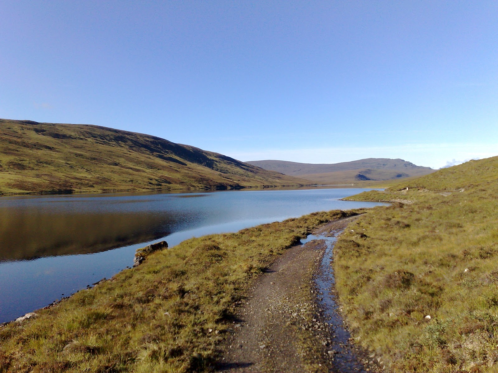
First of all I definitely underestimated the terrain. The sketch map of my Cicerone guidebook showed mostly pathes and trail and only about 15% cross country walking. I quickly realised that the cross country walking usually turned into a trip to hell. No matter where I went, the terrain was boggy, soggy and waterlogged. I was in mud up to my ankles and looked like a pig with dirt all over me. Even worse you could not usually tell beforehand how deep the mud would be. So often I just stepped onto what looked like solid ground and took a fall covering myself with more mud because it turned out a peat bog again. On top of all that the terrain got really steep and rocky (in between the muddy bits) once I was in the Highlands. My feet have not been dry for two weeks straight and started showing it. Not even on the Florida Trail have my feet been that bad. I had blisters and raw spots from rubbing all over my feet. Sometimes I just had to stop walking early because I could not stand the pain anymore. I usually average about 35 to 40 km per day, but on this stretch I was lucky to do 25 km....

Thousands of midges on my tent
Next big problem were the midges. I had known about them but I did not expect them to be that bad end of August. They were actually even worse than all the mosquitoes in Alaska!!!! There is a big difference between mosquitoes and midges: DEET works against mosquitoes, but does not seem to have much effect on midges. Mosquitoes are also relatively big - even if you get some in your tent you just kill them and then have a good night's sleep. But midges are so small  and they are so numerous that you actually breathe them in. They get everywhere and once inside your tent they are too many to kill them all. Things got so bad that I actually started cooking inside the tent - not in the vestibule, but inside the tent - something I have never done before. Packing things in the morning was a great logistical effort because you want to minimise your exposure to the midges as much as possible. It was difficult to even get a break, because I would be eaten alive by the midges as soon as I stopped moving. Therefore also no chance of airing my feet which did make my foot problems worse.

In hindsight another big problem was that I did not bring any overview maps. I just brought the Cicerone guide book sketch maps and the GPS. Unfortunately the GPS maps for Scotland were really bad and hardly showed any trails or tracks. Sometimes even roads were lacking. And therefore I could not make up alternative routes in order to avoid the dreaded cross country sections. In the end I was just counting days: Only 4 more days in this shit, only 3 more days and so on.

Bothy
There are some very nice bothies (shelters) in Scotland which are maintained by the MBA (Mountain Bothy Assosciation). But unfortunately, due to vandalism MBA has asked all map makers and guide book authors to remove the locations of their bothies!!!! So neither my guidebook nor any map showed the location of a bothy - I would just come across them by coincidence. I have great difficulty understanding this secret policy for bothies that can be a life saver in emergencies - if you know where they are!

Scotland can be nice...
After one week it was already apparent that I could not keep my schedule. Luckily I had met another long-distance hiker who had given me the OS map for that area and by that stroke of luck I was able to work out an alternative detour route through Ullapool. I urgently needed to resupply. I had started with 9 days worth of food but being already 2 days behind schedule I was running out. By another stroke of luck I was even able to get a reservation at the youth hostel there. Right now is tourist high season and everything seems to be fully booked all the time. And so I had a bit of well needed rest in Ullapool and could let my feet heal a day. Unfortunately, I had the worst fall of my whole trip in Ullapool - I slipped in the shower and fell right on my tail bone which is still hurting now 10 days later and makes it awkard to sit. But from Ullapool onward I started counting the days until I would reach Fort William, the West Highland Way and REAL trail again.

But things would get worse before they got better and that brings me to the last problem: the weather. The weather has not been very good (3 days of sun in 15 days) but not very bad either. It is drizzling most of the days but there are not too many torrential downpours. But it is much colder than I expected. One morning I woke up and found ice on my tent. And this was August 25th and the altitude only 300 meters....

To sum it up: Scotland is a place where I definitely do not want to hike again in the near future. And I find it hard to understand why Scotland is such a popular hiking destination especially for Germans. Yes, the landscape is very beautiful and remote, but you pay a very high price for that. And personally for me it has not been worth it. I would rather go to Scandinavia where you have similar landscape, but easier terrain and footing - and no midges!

But things are going to improve now: I have made it to Fort William and this means the start of the West Highland Way with hundreds of fellow hikers, decent trails and a shop around every corner. And soon I will be out of Scotland and on the Pennine Way which I have hiked before and really enjoyed. Things will only improve from now on...