Showing posts with label Southern Europe. Show all posts

Monday, 10 February 2014

A hike through Southern Europe: Conclusion

There were two ideas behind this hike: Firstly I wanted to hike all across Europe from the Southernmost point Tarifa to the Northernmost point North Cape and this was the the first half. Secondly I wanted to find out whether you can comfortably hike through fall and winter in Europe. The emphasis was on „comfortably“. I had done several winter hiking trips in Germany and Scandinvia but when you have to deal with a lot of snow, very little daylight and constant subfreezing temperatures you won't be comfortable over a period of several months, especially when you are camping most of the time.

French-Spanish border on Nov 4
Let's start with some data: The total distance was about 3,800 km and it took me 5 months. 760 km per month is not much for a thruhiker. Why has it taken me so long? The most important limiting factor was the lack of daylight. I was hiking through the shortest days of the year with only 10 to 11 hours of daylight from November to January. I had planned on doing more night hiking but due to the terrain, the badly maintained trails and lack of waymarking this was not pra ctical. I ended up averaging 30 km per day only. Had I hiked the same route in spring or summer I would have been much faster. I had also learned from my hike through Western Europe in 2012 where time constraints tainted my trail experience. One of the biggest lessons learnt from 2012 was that European trail town offer a lot of sightseeing opportunities and you'll usually need two rest days: one for resting and one for sightseeing. I had now planned accordingly: This time I had no fixed end date and had planned for additional town days in my time and financial budget. Hiking in winter also meant that your body needs more down time to recover from cold temperatures and bad weather. In Germany and France (September and October) I stuck to my usual schedule of having a rest after 7 to 8 days of hiking whereas in Spain (November to January) I had a town stop every 4 to 6 days.

I spent an average of 580 EUR per month (excluding shoes which I had bought in advance and shipped to me on the trail and the flight back) but I definitely spent most of my overall budget in Spain. In Germany and France I had less town stays and spent them usually in cheap campgrounds whereas in Spain I stayed in cheap hotels, ate out much more and did a lot of sightseeing.

Reservoir in Catalunya
The fall and winter aspect had been the most important factor in choosing the route for this hike. I tried to get South as quickly as possible and to avoid high altitude whenever possible. As on every long-distance hike there were spectacular and boring stretches. The first bit in Germany along the river Rhine and Saar were surprisingly spectacular wheras the first half of France along the river Mosel all the way to Le Puy was pretty, but overall nothing special and sometimes a bit boring. Things improved after Le Puy and became really great between Carcassonne and the Pyrenees. Then the biggest surprise: The route in Catalunya and Valencia was downright breathtaking and I cannot understand why this region is not more popular with international long-distance hikers. The rest of the hike through Murcia and Andalucia varied from a bit dull to very pretty with the occasional highlight, but there were definitely too many olive trees. Overall this has not been the most spectacular hike I have ever done but for me personally this is not a very decisive factor.

An unexpected highlight of this route were the trail towns in both France and Spain. I have never done so much sightseeing on any other hiking trip. In France the highlights were Metz, Dijon, Le Puy and Carcassonne and in Spain almost every little town along the route was a great photo opportunity and had at least one little cultural highlight.

Frozen water source
The most interesting question for me has been how I would fare in fall and winter conditions. It was unusually warm until mid October and I was almost suffering in my winter quilt. The Massif Central was the first „weather trap“ with cold temperatures and lots of rain. But after Carcassonne summer was back and even the low Pyrenean crossing in early November, my biggest weather fear turned out to be very easy. In mid November an unusual rain front passed through Spain. Three days of consistent heavy rain led to land slides and snow at high altitudes. The coldest stretch of this hike was Valencia where I had sub freezing temperatures on most nights. Frozen water sources became a big problem for me. Still hiking was pretty comfortable because it was usually sunny during the day and temperatures generally rose up to 10 - 15 C. There were only a few overcast and windy days when day time temps did not get up to 10 C and made hiking a bit chilly. Wind became a bigger fear for me than temperatures. I had to deal with gusts up to 100 km/h! Andalucia was the last weather obstacle for me. I had chosen the lower Northern variant but still had to go up to 1,700 meters in early January. This year snow line was around 1,500 metres in Andalucia and even at 1,700 metres the amount of snow did not pose a problem for hiking. Unfortunately I cannot tell if the Southern variant that goes up to 2,200 metres would have been passable at this time of the year. It rained surprisingly much in January but other than turning the trails into mudslides this was not a huge problem: Even at night temps did not fall under 0 C once I was out of the mountains.

Snow in Andalucia in January
Overall I did not „suffer“more from the weather than on any other summer hike. I was never really cold at night in my winter quilt. The biggest restriction was that due to low night temps I was pretty much confined to my quilt once I had stopped hiking. Reading or playing with my smartphone would invariably lead to frozen fingers. I slept a lot in December and January! There were only a few days were I felt miserable the whole day due bad weather – not more than on any other hike. I think that Spain is the ideal winter hiking destination for Europeans and I will definitely come back for that reason. A big advantage of hiking off season was that there were absolutely no ticks and mosquitoes.

Once out of Germany I hardly met any other hikers on the trail. The only exception was the GR 65, the pilgrimage trail in France. This was a lonely hike! I hardly met any single hikers, only some hiking clubs that were out for the day in France in Spain. 

So: Did I like this hike? Yes, absolutely! It was perfect for a fall and winter hike and for me personally it was one of the most enjoyable and relaxed hikes I have ever done. Would I recommend it to a friend? That depends. If you are looking for a winter hike or a cultural route this hike is ideal. But if you are hiking in the summer months and/or looking for an alpine route there are better routes. Actually the Southern part of this hike is almost impossible to hike in summer because of heat. I enjoyed this hike so much that I am already looking forward to part 2 from Germany to the North Cape which I will probably hike in 2015.

Hiking the GR 7 in Spain: Conclusion and tipps

I had chosen the GR 7 and my little low-altitude Pyrenean detour in Spain because I had been looking for a long-distance trail in Europe that can be hiked in fall and winter without any major snow and temperature problems. The GR 7 turned out to be the perfect solution. Because I could not find many alternatives to the GR 7 my expectations were pretty low and I was more than positively surprised by what the GR 7 has to offer. Two aspects stand out:

Landscape: I had expected lots of rather dull hiking in dry countryside. Instead I was surprised with a variety of very different and absolutely stunning landscapes. My personal highlights were the mesa-like mountains in Catalunya, the sierras and canyons in Valencia, the National Parks in Andalucia. I hiked a lot in beautiful pine and oak forests. But even the more cultivated landscapes were interesting: Flat dry Murcia with its endless fruit plantations made me aware of where most of our supermarket produce comes from. And feasting on wayside oranges and khaki was a culinary highlight.

Antequera
Towns: Almost every trail town turned out to be a real little gem. Pilgrims often say that they like the cultural aspect of the pilgrimage trails but I found the GR 7 much better in this respect. The pilgrimage caminos take you into the real big towns. You often spend endless hours hiking through ugly suburbs and industrial estates to get to city centre spoiling the overall hiking experience. The GR 7 never goes through real big towns. All the trail towns are either villages or medium size towns at the most and therefore you rarely spend more than half an hour accessing the city centre on foot. Also each town has a little highlight. My personal favourites were: Olot's saint factory, Elda' s shoe museum, the absolutely stunning view onto Morella when approached from the GR 7, generally all the hill top towns in Castellon, Antequera's ornate churches. On no other trip have I enjoyed sightseeing so much.

But obviously on no long-distance trail everything can be perfect and on the GR 7 the hiking quality varies tremendously depending on which province you are in.

Montserrat mountains
Catalunya and Valencia offer by far the best hiking on the GR 7! Here the trail is almost consistently marked with red and white blazes and signposts. Except for the occasional hiccup due to new roads or wind farms you can navigate pretty well by just following the trail marking. Also you are hardly ever routed on pavement. The percentage of single file track is very high. Still not not everything is great: the trail is often badly maintained and overgrown tracks make can turn hiking into a nightmare. Plus there is the problem of the hunting reserve of Chera: a private hunting estate is blocking an entire valley and also the GR 7. No detour is signposted and for two years the local government has not been able to find a solution for locals and hikers. You will have to climb fences and trespass which I find is a Spanish disgrace for an international long-distance trail. Still, overall the GR 7 in Catalunya and Valencia offers fabulous hiking and I highly recommend this section.

You cross Murcia in only a week and here the trouble slowly starts: Trail marking disappears almost completely which is no surprise as the landscape is so flat that there is nothing to put markers on. But there are great internet resources to help you with navigation. You can download waypoints, a very good and extensive trail description in Spanish and even a rutometro. The landscape is a bit boring and mostly offers no shade at all – so avoid hiking here in summer at all costs.

Sierra Magina National Park
Next the trail splits into a Northern and Southern variant in Andalucia. I chose the Northern variant which turned out to be the real low light of the whole hike. Hardly any trail marking and the little marking that there is is often misleading or just plain wrong. There are several very long stretches of roadwalking although mostly on low traffic country roads. Except for the rather nice National Parks all you will see is olive trees – millions of them. You will mostly be hiking on dirt roads that turn into one huge mude slide when it rains. Therefore I definitely recommend choosing the Southern variant instead.

For the rest of Andalucia the two variants join again – but unfortunately the trail marking does not get a lot better. But at least you will mostly be walking in National Parks now that offer some nice scenery. Still I am surprised to see that most foreign hikers walk the Andalusian part of the GR 7 although in my personal opinion this section is not the best of the trail. If you only have limited time and want to see the best part of the GR 7 hike in Valencia or Catalunya.

Now I have a lot of tips for future hikers:

Navigation: As I have described above the quality of trail marking varies tremendously. If you want to hike the whole GR 7 in Spain I highly recommend bringing a GPS with the relevant gpx tracks. I would not have been able to hike the trail without it! The GR 7 is not even marked on most IGN maps. I have hiked the trail with the Garmin maps for Spain on my GPS and gpx tracks. As a paper backup I have downloaded the relevant 1:50.000 maps from the IGN website and pieced them together into a strip map set with the help of a graphic programme. This is a hell lot of work and it took me a week to create the 118 A4 pages that cover the GR 7 in Spain. Map download from the IGN Spain website is free for personal use.

Free camping: Free camping was surprisingly easy along the GR 7. With a little bit of planning ahead you will usually find a spot where to tuck away at the end of the day. I camped more often on soft pine duff than expected. Only the vast agricultural areas in Murcia posed a bit of a problem and needed more planning. It was not difficult to tuck myself away in the endless olive tree plantations in Andalucia, but when it started to rain the ground turned into a quagmire and camping into a very muddy experience. A lot of terrain has been terraced for agricultural purposes or for re-forestation. This is ideal for campers as it provides flat camp sites even in hilly or mountainous areas.

Water: I hardly ever carried more than 2 litres of water but this amount might be misleading for future hikers. I was hiking in dead winter and although I had mostly pleasant temperatures it can not be called hot. Hiking here in spring or fall you will definitely need more water. Almost every day you will pass through a town or village where you can stock up on drinking water. Even in little villages you will find a water fountain or at least a water tap although you might have to hunt around for it. There are springs and piped water along the way but unfortunately you cannot rely on the IGN maps in this respect. Half of the time the springs shown there did not exit whereas other springs were not marked. But usually you will pass farms in regular intervals and in an emergency you can ask for water there.

Dogs: Spain is dog country! There are dogs everywhere and wherever you go you will be greeted by a barking concert. Spanish people often have little compounds in the middle of nowhere. These are used as sheds for tools and machinery, growing vegetables or raising chickens and goats. These compounds are usually fenced in and guarded by dogs. Their owners show up only once a day for feeding. Although I am a real wuss when it comes to animals in general and dogs specifically I was not afraid of Spanish dogs and have not had a single frightening dog incident on the whole GR 7. The big and aggressive dogs are either fenced in or on a chain. Free ranging dogs were always bigger wusses than myself. They come running after you and bark like crazy but usually only turning around and looking at them makes them run away!

Internet: Spain is wifi heaven! Even small towns usually offer free wifi somewhere, usually from the ayuntamiento (city hall). Every single hotel I stayed in had free wifi. On top of all that you can get data very cheap with a prepaid SIM card. There are various cheap providers but to give you an example: I used a prepaid SIM card from tuenti for which I paid 6 EUR plus tax for 1 GB of data valid for a month. Phone calls are also cheap which was useful for making hotel reservations.

Ares del Mestre
Hotels: Spain is a cheap country for Western European standards which allowed me to stay a lot more in hotels than I normally do on a hike. On average I paid around 25 € for a single en suite room including wifi and satellite TV. Usually there is no breakfast. Another nice gimmick is that Spain has a very late check out time: You can almost always stay till 12 noon. I never had a bad hotel experience. Every single hotel oder hostal was very clean and had decent bed and bathroom facilities. Being such a Southern country Spanish hotels are not really prepared for the cold. Usually there is no central heating and if there is it is not working well. Rooms are heated by the air conditioning which can take a while. The biggest problem however is sound proofing. As Spanish hotels are always tiled and not carpeted sound travels far. Be prepared to hear the person next door snore... If you are sensitive to noise definitely bring ear plugs. As I hiked in winter it was easy to find accommodation and prices were at their lowest. You might have to pay more in warmer months. I speak Spanish and could call ahead to make a reservation. If you don't speak the language use booking.com which can even result in lower online prices. Except for the very little towns most hotels along the trail can be booked through there.

Dangers and annoyances: My biggest annoyance were overgrown trails. Because Spain is such a dry country everything is prickly and out to scratch you. Hiking in shorts is often not a very good idea. Hiking in winter I did not have a heat problem but I think this would be a huge problem in warmer months. 
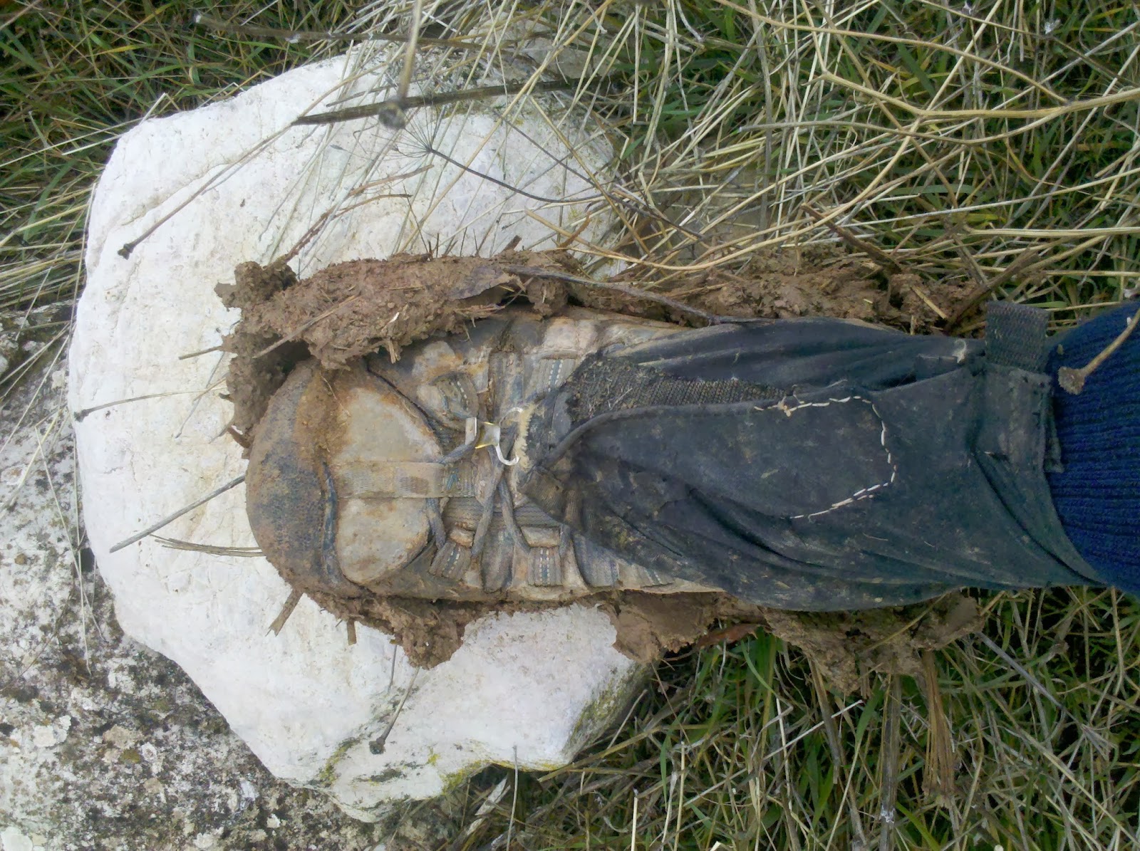
I had several days of rain which had the unpleasant effect that the trails turn into mud slides. Hunting is a big sport in Spain and especially on weekends you'll be passed by dozens of hunting dogs and hunters. The dogs are not interested in you but you might want to take care that you are seen and recognized as a hiker. I wore a neon orange cap that made me look like an idiot but better a idiot being alive than a dead hiker.... Sometimes you have to cross cattle country but luckily Spanish cows are very peaceful. They usually ignore you and I did not have a single cow incident on this hike. My other animal „friends“ are ticks and I am happy to say that I did not have a single tick bite in Spain. I guess it is just too dry for them. Overall I found Spain to be a very safe country. Just keep in mind that there are not many hikers and locals often don't know what to think of you. Spain is in deep recession and a quarter of the population is unemployed. Economical reasons force people into a subsistance lifestyle again. Old abandonded farmsteads are inhabitated again and you'll see some interesting characters out there like truffle hunters and shepherds.

Thursday, 30 January 2014

The end: Ronda to Tarifa

View from Ronda
Although this last stretch was definitely a scenic one it was a bit tainted for me because of health issues. Very unexpectedly I had developped a middle ear infection! It started very harmlessly in Ronda with a slight ear pain. When it did not get better I decided to see a doctor. I had found a medical centre in the internet and descended early Friday morning into the reception of my hotel - where I received the first blow. This Friday was a fiesta! Again I had become the victim of the Spanish fiesta disesase that strikes innocent tourists unexpectedly...

But the owner of the Hotel Arunda II was not only helpful but knowledgable. Patiently he explained to me that in Spain the emergency room takes care of tourists - and that treatment is for free. I felt a bit embarrassed because ear pain is definitely not a life threatening situation but he insisted that I should go to the ER. And for sure there were already other patients waiting. Soon it was my turn and the young doctor turned out to be very enthusiastic about me: She had studied in Berlin and loved the city. We talked more about Berlin and the bad conditions in Spain than about my ear, but she told me I had an infection and prescribed ear drops. It was an interesting insight into modern Spanish life to hear her complain about her working conditions - and frustrations. I got the ear drops from the pharmacy and hiked happily out of town hoping that my ear problem would disappear soon.

Unfortunately I could now not hear much in the infected ear which made for strange hiking. The scenery was truly beautiful and in another National Park but I was a bit distracted and disoriented. Although a national park cows were grazing everywhere and I started to worry about camping. Whenever I thought I had found a nice spot I either spotted cow poo or a cow sneaked up on me from behind. Luckily by climbing a fence I got out of cow country and found a nice spot. But my hearing problems continued... I realised that Ubrique was the best spot to seek treatment again for what I thought was water in my ear. It was the only substantial town before Tarifa and therefore my best bet. I went straight to the medical centre of Ubrique where they did not even take any data from me. You just queue with everyone else and see the doctor for free. What he said came as a shock for me. No water in the ear, no slight infection, no: a full blown middle ear infection and he prescribed antibiotics. I was not happy... but what choice did I have? I bought the medication and headed out of Ubrique after a last shopping stint at Lidl.

Again I was in a National Park abounding with oak trees that were harvested for cork. That means that the oak barch is cut off from the bottom of the trees which gives the forest kind of a weird look. Still oak forest looks very enchanting.The GR 7 actually becomes single file trail for a while following a lovely stream. And because of all the rain wild flowers had come out everywhere. Although it was January I felt more like spring! The only thing that kept worrying me was the ear infection - and the weather that turned bad again... Next was the beautiful hilltop forest of Castillo de Castellar but it was raining badly and I spent most of the time in the handicapped toilet waiting out the rain and researching travel options in case my ear problem did not get better.


Unfortunately a lot of road walking was next - even next to a busy road, but luckily there was brand new separate bike lane that made things easier. But when I turned off onto a minor road and started searching for a camp site I discovered I was in cow country again. Everything was fenced off - and I did not know what was behind the fence. I ended up sleeping under a high voltage power line that was cow free. But there were not only cows: This area was full of storks! They were nesting everywhere. Really, every powerline had its stork nest attached. I have never seen so many storks before in my life.

Two more days and one night to Tarifa and even on these last hours the GR 7 showed how beautiful - and how annoying it could be. I had to enter one last beautiful national park and everything seemed nice and easy. There were even sign posts for the GR 7 and the occasional trail blaze. And then I was standing in front of a high still gate with spikes on top and signs saying "No trespassing". Again, no idea what was going on. I ended up trespassing through another private property where only this lovely pig got upset about me and then fording a river and getting wet feet before joining the trail again on an old abandoned road. Then surprise: I saw the first long-distance hikers on the GR 7 in Spain, a Belgium couple whom I explained what to expect about the trail closure. 

The next - and expected problem - was the weather. The forecast was for torrential rain over night with very strong winds. This was not what I had hoped for for my last night on the trail.. I had know about this for days but could not come up with a good solution. There were no towns nearby where I could stay in a hotel and also I wanted to finish now. First the landscape looked very promising. Lots of trees and a wide strip between the dirt road and the usual cattle fence. But when it got time to camp things had of course changed for the worse. With rain threatening to start every minute I was desperate for a campsite - but nothing but open pastures or impenetrable brush. Then I saw my chance. There was an opening in the strip between the road and the fence. With a little bit of clearing it was just big enough for my tent and totally sheltered from the wind by the thick brush.

Although definitely not the most scenic camp site of this trip I thanked God every five minutes for it when the storm broke loose. The winds were incredibly strong which was to be expected from the many wind farms nearby. Despite the sheltered site two tent stakes came loose overnight and I hardly slept at all. When the storm finally stopped in the early morning hours I fell asleep for a couple of hours only to be woken up at sunrise from the cars passing by - I was camped only half a metre from the road....

But nothing could stop me now: Only about 25 km to Tarifa now! But they dragged on and on despite the weather improving and the sun coming out. Then finally I saw the sea! And then I saw the mountains behind it and realised that I was looking at Africa! The last final stretch was along the beach. 7 km of fine white sand - and strong wind. Luckily there was also a beautiful forest nearby that gave a bit of shelter from the wind. Hiking along that beach was actually not as easy as it sounds. There were deep streams on the beach that could not be waded through and I had to detour to the paralleling national road several times until I gave up and just road walked the last 2 km into Tarifa.

View onto Africa from Tarifa
It was a strange feeling to finally arrive in Tarifa after 3,800 km and five months on the trail. I was exhausted from the sleepless night and the worries about my ear. But I was also very happy about the hike that I had enjoyed thoroughly. And I was already looking forward to the second part of this hike across Europe from South to North: Next would be Germany to North Cape. And the good news was that my hearing problem was finally disappearing! I went to my prebooked hostal, took a long hot bath and then celebrated the end of this trip in a vegetarian restaurant.

The official Tarifa finish photo
Next morning I had a stroll around town to find a good place for the finish photo. Unfortunately, the Isla de las Palomas which sticks out into the sea is closed to the public now, so that you cannot access the light house at the Southernmost point of Europe. But I walked up the causeway that divides the Atlantic Ocean from the Mediterranean Sea and came to a map and a signpost officially claiming that I was standing now at the Southernmost point of Europe. So I guess this is the official wind blown finish photo!


Let me finish with a short outlook: If my ear problem permits it I will soon fly back to Germany to prepare my next trips and update this blog. There are still a lot of photos missing and I will write the usual conclusion and tips for future hikers. I know from several emails that there are a lot of people reading this blog who are planning to hike the GR 7 soon. Let me know if you have any questions and I will try to answer you or even include the information into a final blog post.

Thursday, 23 January 2014

Antequera to Ronda

 The weather even worsened. The forecast was torrential downpours for two more days. I have plenty of time left before my flight back so I decided to stay these two days in Antequera although I didn't really need such a long rest. I chose the cheapest accommodation, the Hostal Plaza San Sebastian for 22 €. Then I tackled the tourist information in order to plan my visit. They were extraordinarily organised and I soon cut out a plan being my typical efficient German tourist self.

Antequera has two claims to fame: Stone age burial sites and to be the Spanish town with most churches. The stone age monuments were quite interesting and I was most impressed by the fact that they are now situated right next to a Repsol gas station. I tackled the churches with the help of a guided tour and I soon became the pet guest of the whole tour for asking hundreds of questions. After the tour the tour guide even offered me to give me her phone number in case I had more questions but I fear she was not really serious about it...Maybe I had asked too many questions.

The churches were indeed impressive and I saw dozens of martyrs, different Marys with even more different baby Jesuses and all the statues that are carried around in the Semana Santa (Easter).I was duly impressed but the most interesting experience was visiting the chapel and little museum of Madre Carmen del Niño Jesus. You don't have to know her - I did not either. She was born in Antequera, married the love of her life despite her parents' wishes - and suffered from it. Her husband was a gambler and drunkard but she managed to convert him to a more Christian life before he died. Widowed she founded a new religious order at age 50 and their headquarter is still in Antequera. The order is very small with only about 300 nuns left but they have created this small museum with Madre Carmen's cell and some devotionalia. Apparently interest in her is not that great among tourists as I was the only visitor and got my own private tour by a nun double my age and half my size and weight including plenty of recommendations like "Pray and give to the poor!" Well, you can think about it what you want but I find these encounters more Spanish than visiting the major tourist sites.

I had been so efficient that I had nothing left to do in Antequera on rain day two and therefore took a day trip to Malaga. In case you are hiking the GR 7 there are plenty of outdoor shops in Malaga including a huge Decathlon and a base: shop right in the train stations shopping centre. I dislike Picasso and skipped all the Picasso related stuff - there are still plenty of art museums. Today´s programme was a big contrast to yesterday´s: Plenty of naked women in the Revello de Toro museum instead of virgin Mary. I loved the free modern art museum and the Collection of Carmen-Thyssen-Bornemisza but in the end I was now itching to go hiking again. 

The next day finally brought sunshine again. It was now three days to Ronda, my next stop. Again, I did not need a rest day again so soon, but Ronda is such an important tourist sight that it would be a shame to just hike through. This stretch is not exactly exciting. At least the olive trees are now interspersed with almond trees... Well, it is not that bad. Day one was boring hiking along plantations. Although the sun was out it was freezing cold and I feared I would end up camping under another olive tree. But luck was on my side.


The trail passes through the gorge of El Chorro which is very popular with climbers from all over the world. Although El Chorro is a tiny settlement there are various refugios - all advertising in English. I had camped in an incredibly nice pine forest and had even been able to get some of that olive tree plantation  mud off my tarptent. Early next morning the views down to the El Chorro reservoir were fabulous. Unfortunately you have to descend down to the reservoir and then hike up again which sort of screwed up my schedule. 

The problem now was that more rain was predicted, actually quite a big downpour over night. I did not want to camp in the mud under olive trees in this weather and hoped for a better camp site. It did not look good first: Olive trees, almond trees and cereal fields, something I had not seen in a long time. Because of all the rain the landscape was actually quite green now. I even saw the first almond trees blossoming. And then, right at the end of the day when I needed it I came across a big reforestation area. Free camper's paradise: Fabulous pine trees on flat terraces with no under growth. I was so sheltered from the trees that I hardly noticed the night's downpour. I had hoped for a short day into Ronda but the hike dragged on and on. There were even 4 km next to very busy road. On the other side I followed an endless fence line complete with barbed wire and warning signs. I first thought it is another hunting reserve or golf course, but it is actually the Ascari race course

Approaching on the GR 7 Ronda lies behind a mountain and you don´t see it till the very last minute. I thought I would never get there but luckily I had booked a cheap hotel. Ronda is surprisingly busy and like before in Antequera I am not the only one in the hotel (Hotel Arunda II) any more. Ronda has a spectacular setting and of course the famous bridge. And it is full of tourists, even in winter. This picture is taken from Paseo Kazunori Yamauchi. I wondered why such a prominent landmark in Ronda is named after a Japanese. The reason is very modern: Kazunori is a computer game designer and one of his games features the Ronda bridge in a car race... Modern times in Spain...I was a bit underwhelmed by Ronda. Although definitely a nice town the sights were not better than in any other town I have visited on this hike. I don't quite understand why it is so popular.

Ronda has been the last stop before the end. It is now five days to Tarifa and the end of my hike. The weather forecast looks good so far... Cross your fingers for me.


Friday, 17 January 2014

GR 7 Tramo Norte in Andalucia: Conclusion

The GR 7 splits into a Northern and a Southern variant in Andalusia. I had chosen the Northern variant for the simple reason that it is lower and I was hiking in winter. From what I could see of the Sierra Nevada in the distance this has been the right decision for me: there has been plenty of precipitation and therefore plenty of snow in the Sierra whereas I had not encountered any snow problems on the tramo Norte.

But other than in my special situation I would not recommend this Northern variant for various reasons: It is incredibly badly marked. Usually there is no marking whatsoever. Without a gpx track on your GPS you are lost. The GR 7 is not marked on the IGN paper maps. It is hardly marked on the ground. There are all kinds of markings for the brand new GR 249 and GR 247 which coincide with the GR 7 at times. These are great. A short bit coincides with the Camino Mozarabe which is also well marked. There are even some local trails that are marked. But not the GR 7. When I found a red and white marker I felt more like "Oh, where does this come from?". I was purely navigating by GPS and map.To make things worse the few signposts that there are are wrong half of the time. I usually got lost when I tried to follow a GR 7 signpost instead of listening to my GPS.

Also the landscape is not really that exciting: There are two good bits: Cazorala National Park and the little Sierra Magina National Park. And although they are very scenic you are hiking through them on forest roads. You are almost always on forest roads or dirt roads anyways. Plus the GR 7 in Andalucia has a high percentage on pavement walking. The roads are not very busy, but still bad for your feet. And you don't want to be on single file trail anyways because it is so neglected and overgrown that you won't find it. What you will see more than you ever wanted to see is olive trees. 28 million of them in the province of Jaen alone. Nothing against olive trees but two weeks of them is too much!

Even the cities are not that great: Alcala la Real and Priego de Cordoba are real highlights, but other than that the trail towns are nothing special. Not bad either, but nothing outstanding. I was much more impressed with the trail towns in Valencia.

Don't get me wrong: the tramo norte is not a disaster but if you don't have a compelling reason to hike it there are much better alternatives.

If you want to thruhike the GR 7, then choose the Southern variant.
If you want to hike in Andalucia in the mountains, I would highly recommend the brand new GR 247 "Bosques del Sur".
If you want to hike in Andalucia in winter and avoid high altitude, try the brand new GR 249 "Gran Senda de Malaga"
If you want to hike just one part of the GR 7, hike the section in Valencia. Much better marked, fantastic landscape and trail towns and a lot of single file trail.

Alcala la Real to Antequera

Fortress of Alcala
Alcala's claim to fame is its huge old fortress. Beautifully restored and with great views down onto the city. Arabs and Christians changed ownership of this hilltop city and fortress so many times that I could not keep track. Alcala was a border town between the Arab kingdom in Spain and the Christian kingdom. When the Christians finally conquered it for good (by poisoning the fortress's water supply) they built a huge church on top of the hill. But in the 18th century everything fell into disrepair. It is now hard to imagine from the ruins that this was once a bustling town. Still, the whole huge complex is definitely worth visiting.

Fountain in Alcala
I was staying in the Hospederia Zacatin where I was even charged less for a room than the official price list: 27 €. But I was not happy with their restaurant. Because they had not expected guests there was no menu del dia. After I complained they cooked up something for me but it was downright bad. The worst of all was that I had so much been looking forward to my beloved tinto de verano - and for the first time in Spain I was only given a glass of it with the menu. I decided not to visit this restaurant again but Alcala was strangely devoid of eateries despite its size. But I was lucky: By pure coincidence I found a Chinese restaurant - totally devoid of guests. It still offered an AYCE buffet. I ventured in and was assured that the AYCE buffet would appear within 10 minutes. To my great surprise it actually did: They cooked up several dishes to choose from only for me. And although definitely not haute cuisine it was quite good - and very filling. So if in Alcala la Real try the Chinese restaurant Hongkong.

The 5 day stretch from Alcala to Antequera was definitely not a highlight of this trip. First of all the weather was bad. It rained every day! This is a lot for Andalucia where it does not rain for months on end. I have the feeling that almost all the year's rain fall had come down since Christmas. Beside getting wet the biggest problem with the rain was that it converted the "trail" into one big mud slide. To make things worse the mud here is incredibly sticky. Hiking became very exhausting because I was constantly carrying around 1 kg of mud sticking on each shoe and another pound on each trekking pole. Sounds funny but I assure you it is not. I looked like a pig. My trousers were a mess. My backpack looked even worse than usual and I don't even want to talk about my tent.

Which brings me to the next problem: Camping in this weather on this ground. I was more or less constantlyhiking through olive tree plantations. The good news is that this usually guarantees flat camp sites. But with all this rain the ground had turned into one big squishy mud pool. As it was  harvesting time the ground had been destroyed by tractors creating huge mud puddles. I was dreading rain over night because the ground was so saturated that it could not absorb more water - and I was fearing to wake up in a little lake.

Another Spanish specialty was disturbing my night peace. Spanish farmers tend to have "outposts" in the middle of nowhere: a little shack or house in a fenced in compound. In order to guard this property they keep dogs on it. Not one, not two - usually half a dozen. These dogs are left alone the whole time except for feeding times. Apparantly they get so bored that they keep barking - all night long! And sound travels far in this landscape. I returned to using ear plugs. Luckily (for me) the dogs are chained and/or fenced in and not hunting clandestine campers. One night I camped so late that it was already dark when I chose my camp site. And I did not realize that I was very close to one of those compounds. I only noticed when the owner turned up for dog feeding - and all hell broke loose. The dogs took the whole night to calm down.

But the main problem of this stretch is that it is quite boring. Olive trees and more olive trees - and then some more. Nothing else but olive trees. If I see another olive tree I'll scream. I don't even like olives. So day after day I was hiking (or sliding) up and down hillsides with olive trees. Not exactly the most exciting hiking. There was one stretch approaching Rute when the trail leaves the olive trees and meanders between olives and national park. I was skeptical: My map did not show any trail. I had lost the gpx track for that section - and I knew from experience that the trail marking in Andalucia is scarce to non-existant. I actually found where the trail took off from the usual dirt road. I climbed up higher and even found trail markers. There was not really a trail and it looked like no one had hiked here in years. I had to camp in yet another olive tree plantation and when I woke up it was so foggy that visibility was less than 50 m. The trail markers led into one big scrub with no sign of any trail. I was so fed up that I just descended on dirt roads and ended up road walking.

This used to be a brigde
And this is my main frustration with the GR 7 in Andalucia. It has great potential but it is so neglected that I cannot really recommend hiking here. At least there was no mud on the road.... There were some other bad surprises: A washed out bridge (no problem to cross the little stream though) and a completely washed out trail coming into Cuevas San Marcos. The trail was supposed to be on an old abandoned road. There were even some red and white markers! The road signs that "Road closed" but I had assumed it is still passable for hikers. No such luck: The road had completely crumbled into the river and of course it started to rain when I realised my situation. I climbed up some olive tree plantations and walked around it - sometimes sinking ankle deep into mud. At least the weather was so bad that there were no farmers around wondering what I was doing on their property.


The towns were not much of a highlight either - except Priego de Cordoba. This would have been a great town for a rest day. Unfortunately I got there on a Monday when almost everything is closed. A real shame because Priego boasts several splendid Baroque churches. Only one was open and gave me a taste of what I was missing. The guy in the tourist office was really enthusiastic as well: He had even hiked 20 km of the GR 7 and printed out trail descriptions for me - but I still got lost. Best of all he gave me a little free sample of olive oil and I learnt that fresh bread and olive oil actually make quite a nice lunch.

But eventually I made it to Antequera - and just in time as another storm front is moving in. I swear I'll stay put until it has stopped raining... But only 250 km to go now! Hopefully my shoes will last that long.


Saturday, 11 January 2014

Quesada to Alcala la Real

I am now hiking through hardcore olive country. Olive trees everywhere - millions of them. And now is harvest time. I had to learn that hiking in olive country during harvest time is a noisy business... This is how olives are harvested: A plastic net is placed underneath the tree and then the branches are shaken - either by beating them with wooden sticks or with a stick-like motor-device which leads to a constant humming in olive plantations. The content of the nets is then collected and transported to the olive mills. Early morning and late evening basically everyone on the roads here is driving a 4WD (to get up the steep slopes), towing a covered trailer full of olives and carrying the tools of the trade (plastic nets and wooden sticks). Afterwards the olive trees are pruned which adds chain saw noises to the concert. The cut off branches are burnt next to the fields and therefore smoke is often in the air.

Hiking here can be a bit boring - all you see is olive trees. Harvesting time also makes stealth camping interesting because you don't know if you are going to be woken up by farmers... On the other hand you'll always find a flat clear spot in these olive plantations for camping. But as there is no undergrowth and the trees are usually far apart it is difficult to hide. I set up camp very late and try to be away before sunrise and the arrival of the harvesters.

Nothing but olive trees
Hiking in winter I can observe very well what great influence the location of the camp site has on night conditions in the tent. On my first night out of Quesada there was nothing but olive trees to camp. I got a bit scared when some of the plantations were suddenly fenced in. Do the owners think someone will steal their olives? Luckily, this fencing is the exception. Still, there was a lot of harvesting activities in the area and I tried to get away a bit. After the recent rains the ground is incredibly muddy and I went down a flooded dirt road that seemed unaccessible by car in this state. Unfortunately this also brought me close to a river and the plantation ground was so soft that I had to camp in a patch of grass in the open without tree cover. The result: First the tent got soaking wet from condensation which then froze over completely in the morning. When I broke camp I heard workers nearby and tried to pack up quickly. I nearly froze my hands when rolling up the frozen tent...

Although it can be freezing cold at night the days are warm, almost hot. I did a quick shopping in Jodar and was then off to Torres. The GR 7 climbs up a mountain and then descends steeply into the next valley. The climb up was easy on a dirt road and the views from the pass down into the valley great. But how would I get down this steep slope? Someone had driven up an old car and then pushed it down the slope. The car wreck seemed an awful reminder of what can happen to you if you slip... But the descent was not as bad as it looked and I was soon down in olive country again. The climbing had taken its toll and I did not make it as far as expected that night. I ended up on the the steep ascent up to Torres when the sun set. One of the terraces rescued me by providing a flat spot for camping. And despite the altitude of 1.200 m and no tree cover I did not have frost in the tent.
Sierra Magina

Next day was a real highlight as I was crossing another small National Park, Sierra Magina. From Torres I steadily climbed up to 1,600 m on forest roads. Once up on the pass I was greeted with spectacular views of the snow covered Sierra Nevada. I sat on top of the pass and had lunch. It is January and I was sitting there in the sun enjoying the fantastic views - and felt incredibly happy.

Unfortunately this happiness quickly disappeared when I realised a couple of hours later that my gpx track had been cut off. Although I had downloaded the whole track for this Northern variant only half of it was on my GPS. My only explanation is that the track must have had more than 10.000 track points and had therefore been cut off when sending it from my computer onto the GPS. That meant no tracks for over a week!  And here the GR is badly or not marked at all. Luckily I have paper maps with the trail marked on them but a GPS track would be much better...

Along the River Cambil
The first trial without gpx track was soon to come. After Cambil the GR 7 follows the valley of the river Cambil. Sounds easy to navigate but there was no trail and I didn't know which side of the river to be on. It did not help that a recent flooding had washed out the bridges and I didn't know if they had been rebuilt. So I decided to camp first - and so close to the river this was condensation hell of course. Next morning the navigation turned out to be quite easy as the bridges had all been rebuilt and "bushwhacking" through olive trees is easy. After crossing underneath the motorway and a bit of roadwalking to Carchelejos I came across another highlight of this section. After climbing up to a pass the GR 7 descends into a dramatic river gorge on an old foot path. The views down into the gorge were fabulous and I had another "Life is good" moment. I even found a nice pine tree campsite in the evening in a terrace. Life has been very good on this stretch: Nice sunny weather during the day and some fabulous scenery amidst the endless olive trees.

Only the last day into Alcala la Real dragged a bit. I had chafed my feet on the downhills and I was hurting a bit. Plus Alcala does not come into sight until you are literally standing in front of it. I had a reservation and just limped right to my hotel where I spend the evening trying to heal my feet.

Tuesday, 7 January 2014

Cazorla and Quesada

Cazorla
In Cazorla I stayed two nights in the Hotel Limas where 25 € got me the usual en suite room. The staff there was exceptionally friendly and through the attentive waitress I discovered a new culinary delight: tinto de verano (summer red wine) or vino casera. I first thought that she had offered me "vino casero" (house wine), but vino casera is red wine mixed with lemonade and ice. Sounds horrible but tastes delicious! My new favourite drink.  And best of all: it is usually included in the price of the daily menu. Spanish cuisine is not very refined but I still like it - especially since eating out in Spain relatively cheap. To give you an example: the menu del dia in the Hotel Limas was 9 € and includes two dishes, bread, desert, a full bottle of wine and a full bottle of lemonade. In Germany 9 € wouldn't even buy you a bottle of wine. And because Cazorla is in the mountains there is a wide choice of game dishes. I had wild pig sausage for a starter and venison stew as a main dish. After a good meal and vino casera I just love Spain!

Cazorla NP, Castillo de Cinco Esqinas
Cazorla seems to live on two things: olives and the National Park. The little town is full of tour agencies offering 4WD tours into the park. I would just walk... Beside that Cazorla's claim to fame is the only church in the world with a river underneath it. But the same river brought bad luck: Rock falls dammed the river that then flooded so badly that it destroyed the church and half the village. Bottom line is that the church was never finished but with a guided tour you can visit the ruins and the very impressive subterranean river channel.

Cazorla NP
The friendly lady in the tourist information then made me change my plans. I had intended to hike through to Alcala la Real but she told me so much about Spanish Christmas traditions that I decided to just hike half a day and spend Jan 5 in Quesada. The short hike passed through Cazorla National Park and I now discovered what beauty I had missed in the last three days because of rain and fog - I just had not been able to see the spectacular limestone cliffs. There is only one hotel in Quesada and I had to pay more than usual for a room: 33 €.


Quesada by Zabaleta
I indulged in a hot bath before setting out to see Quesada's main attraction: the Zabaleta museum. Zabaleta is a 20th painter born in Quesada and I freely admit that I had never heard of him before - although he is considered one of the most important modern Spanish painters. The museum is huge considering the size of the village and plenty of paintings of Quesada itself were exhibited. I was the only visitor and the friendly receptionist told me more about this evening's events. In Spain it is not Santa Claus who brings the presents on Dec 24 but the Three Wise Men bring them on Jan 6. And this is celebrated by a street parade on the evening of Jan 5 in all Spanish cities and villages - my reason to stay in Quesada. The parade features the three kings, their servants and other Christmas participants throwing sweets at the spectators. The kids write letters with their Christmas wishes and hand them to the kings after the parade who then presumably bring them the next day.


Balthasar and I
The parade started at 7.30 pm and the participants were getting ready in the underground parking lot of the museum. And as a curious foreigner I was allowed to have a good look at them before the parade started. I even had a private meeting with one of the kings! Each year the parade was organised by a different village group, this year by the mediaeval motorcyclists. These is a bunch of motorcyclists who dress up in mediaeval clothes for whatever reason and like this they were also participating in the parade. The kings of course had a car and dozens of servants each. The local kids came prepared with plastic bags for all the hard candy that was thrown. It was fierce competition and I only managed to get two sweets - despite having been a good girl all year. The village band was playing Christmas songs that drove me away soon. I celebrated on my own with a menu del dia and vino casera in my hotel.

But now it is four days of straight hiking to Alcala la Real with a good weather forecast.