Showing posts with label Europe Diagonal. Show all posts

Friday, 14 May 2021

Europe Diagonal: Interlude in Greece

Back in my home base in Berlin I have been deliberating trail options. Not too many countries are open without quarantine and not even all of these are interesting to me as a hiker. And after miscalculating my chances of a straight thruhike to Finland I was now looking for a "safe" option - which appeared in the form of Greece! The country announced complete opening to tourists starting from May 15th - no quarantine, open hotels, open museums and no travel restrictions - only a PCR test required. 

Still my planning didn't first work out. I booked a cheap flight to Crete, which was cancelled only two days later ... After much deliberation I booked another, not quite so cheap flight. 

I had also hoped to be able to get at least my first Corona vaccination during my stay in Germany - but no such luck. And with vaccines being scarce but plenty of people fighting to get it the situation will not improve too soon. But as soon as I am able to scare a vaccination date I will return to Germany - as much as I hate flying back and forth. But this crazy Corona year requires special measures. I will not be able to do one long straight thruhike, but at least I can do several shorter hikes. 

The E4 in Crete seems to be perfect for this weird situation. First of all it is on my route "Europe Diagonal" from Ireland to Greece. The length of the E4 in Crete is around 500 kilometers and can easily be extended into Peloponnes and Northern Greece, also on my route. I'll start at the Eastern terminus of the E4 in Crete and keep going until the vaccination calls me back to Germany.

I am really looking forward to this hike because of two reasons: Although I have travelled extensively all over the world, I have never been in Greece. And after having hiked through snow storms for six weeks in Poland I am ready for some warm weather now!

Thursday, 28 November 2019

Europe Diagonal: Baden-Württemberg

When I entered Baden-Württemberg mid September supermarkets were already selling Christmas sweets whereas I was enjoying warm and sunny hiking day. The little village of Keltern is surrounded by vineyards but unfortunately the local museum was already closed that late in the season. As I was now skirting the Black Forest I was very keen on eating a real Black Forest cake - but none of the bakeries I passed offered it. What a bummer! 

Cloister at Bebenhausen
First highlight was Naturpark Schönbuch, a huge forest area with perfect wild camping spaces - until I realized that Stuttgart airport entry lane must be directly above it ... Planes were starting and landing until 11 pm and the noise resumed at 6 am. The night was quiet though except for a wild boar that was rummaging around next to my tent. Next was a cultural highlight: former monastery Bebenhausen. I was so delighted that I spent too much time sightseeing and ended up night hiking. I was now approaching Schwäbische Alb and it was difficult to find a flat hidden spot. But I was not the only one around. I probably scared a mountain biker who was running down a steep slope and had not expected anyone on the trail that late at night. Up on the plateau I followed a well known trail for a while: I had hiked the Albsteig several years before and had truly enjoyed it.

Up on the Schwäbische Alp
The climate up here is relatively harsh compared to the lower lying agricultural areas. There are no fields but plenty of open meadows where sheep and goats are grazing. I was now hiking the HW 5 but during the few kilometers that this coincides with the Albsteig I came across two highlights: Nebelhöhle, a huge flowstone cave where the temperature is only 10 degrees year round and the fairy tale castle Lichtenstein which was built after a novel written by Wilhelm Hauff. The views from the plateau were wonderful and I was sad to leave the Albsteig so soon.


Lauter valley
But the HW 5 had other highlights for me: In the small town of Indelhausen snails were cultivated until the 1950s - a small snail garden and a monument reminded of that unexpected fact. The trail then followed the little river Lauter (the second river Lauter of this trip!) and the views down into the Lauter valley were incredible despite the slightly bad weather. I was now crossing the river Danube at Obermarchthal. Because of the bad weather there was no traffic on the Danube bike path which a hiked for a short distance before arriving at huge monastery where I had booked a bed for the night. There are no more nuns there and the big complex is now used as a conference centre. I had a big room inside the old convent and arrived just in time to have a glimpse inside the Baroque church - and to join the daily AYCE-buffet. I was the only hiker amidst a dozens of software developpers. This was one of the nicest (and cheapest) accommodations of the whole trip. Had known this beforehand I would have spent a rest day here.

Sunrise at Wurznacher Rieß
But I had to press on despite the rain because I had to leave the trail at Biberach an der Riß and attend a festival in Switzerland. I resumed my hike one week later in the same town. Next I hiked through Wurnacher Rieß, a huge swamp, which was crossed by an old railway line because peat had been collected here in former times. This was unfortunately when the weather turned really bad. Luckily I had brought an umbrella for htis stretch which came in very handy!

I have experienced a lot of detours during my hiking career but the next one had an unusual reason: Explosives Ordnance Disposal! The trail was closed off with warning signs but no detour was signposted. Because it was a Sunday I decided to ignore the signs and hike on. This decision was soon confirmed by a mountain biker who was cycling towards me. There was indeed a big excavation area in the forest but as was to be expected no one was working there. It was difficult to find a hidden campspot that night but luckily refrained from camping close to the forest road.

Alpsee at Immenstadt
Because at 4.30 am a truck came thundering along and loaded trees. I suspect this might have been wood thieves ... At least this way I woke up early and arrived at a huge observation tower (where I could have slept in ...) right at sunrise and had a first glimpse of the Alps. The weather continued to be horrible. When I arrived at Immenstadt the view across the Alpsee was basically zero due to fog and rain. I rented a room and deliberated what to do. I was now joining the Maximiliansweg which would take me up high into the moutains but the forecast for the entire week was cold and rain ... And therefore after sleeping one night over the idea I decided to call it quits for this year and took the train back home.

Saturday, 9 November 2019

Europe Diagonal: Rheinland-Pfalz

I was now on the Saar-Rhein-Weg, another completely unknown German hiking trail. Although the area and the route was quite nice, I was unfortunately passing through on a week-end - and parallel to the trail was a little stream and a narrow winding road where dozens of loud motorbikes were cruising along ... When I approached a village I heard hunting horns and stumbled upon a village fair. The local horn group was playing, I rewarded myself with Blackforest cake and even chatted with some other tourists who admitted of having heard from me on TV ...

But this was going to be a long day ... When I came closer to my planned camping area I passed this lovely village pond. It was already so late that no other swimmers were around. Despite the road right next to the beach I stripped down and skinny dipped. Some locals watched me from afar but I was just happy to be clean again which cannot be said about the beach which was full of goose shit ... The closer I came to my camping forest the louder I heard music in the distance. I already started panicking because it would be hard to fall asleep with an open air concert nearby. But the music source turned out to be tractor and a trailer full of kids who were celebrating  God knows what. And they were moving - slowly but steadily away from me and the nice flat spot in the forest where I finally settled down.

The Pfälzer Wald was a nice area but alas without any cell phone reception at all. I decided to make a short detour into France again and went shopping in Wissembourg. Next I had to overcome a big obstacle: the river Rhine which was problematic, because there are not too many bridges crossing it. I followed the Rhine bike trail to the Rhine ferry where I was passed by hundreds of cyclists who shot me pitiful looks. I hiked more than 40 km that day because walking on flat bike paths was dead easy and the ferry ride did take less than 10 minutes! I could already see the Black forest looming on the horizon once I had crossed the river!

Tuesday, 29 October 2019

Europe Diagonal: Saarland

My trip through Germany started at Perl where I had already passed through on my previous European traverse. But this time all the supermarkets were closed ... Next morning brought me to the famous Saar Bow, a 180 degree turn in the river - a spectacular view and therefore incredibly crowded with tourists. But as soon as I hiked on I was almost alone again in the forest - at least until arriving in Mettlach with the famous porcelain factory of Villeroy & Boch. I could not resist and visited the museum and showroom. Being an ultralight hiker I was at least not tempted to buy anything ...

Camping turned into a bit of a problem that night
because the only small forest was located on a hill too steep for camping. And right on top were there was supposed to be a look out tower according to my map there was now cell phone tower with fences around the whole area. Luckily I found a flat spot right before sunset which was fairly quiet - until I realised that I was camped just a couple of hundred metres away from the church tower with the clock striking every quarter hour until 10 pm. And of course I was woken up in the morning with church bells as well. But the day took a very nice turn because my next rest day was coming up and I had been invited to stay with a fan of my books in Dillingen.

Getting there took me to Litermont mountain with a wonderful view. I could even see the smoke stacks of the steel works in the distance. Dillingen was not directly on my route and therefore I took the bus to get to my host. As she was working in the afternoon I used the spare time to visit an old steel work in Völklingen which had been turned into a UNESCO world heritage site. The area was huge and I could have spent an entire day there taking pictures, learning about steel making and seeing all the art and photography exhibitions. My host even picked me up by car. I did not see much of Dillingen because I was so happy to just lie in bed the entire day and use the internet!

Hiking on I realised that this was not exactly the most scenic part of Saarland. The trail was ok but I was always close to civilisation and continously trying to find a campsite that was out of earshot of the various motorways. One evening I was so happy to find a spot out of sight that it took my a while to figure out that I was trying to camp on top of an old bunker! It was impossible to get my tent pegs in because underneath a very thin layer of earth I hit concrete. It felt a bit bizarre to camp so close to a WW II site but I had no other choice - and I slept well.The Saar-Mosel-Weg even took me right through a university campus where I used the change to charge up my cell phone.

I must say that Saarland was a bit of a disappointment although I had probably just chosen the wrong trail that led my through a very populated area.

Wednesday, 16 October 2019

Europe Diagonal: Luxembourg


Luxembourg is kind of a hikers' paradise with wonderful trail - but unfortunately these are all in the North of this small country. My route was leading me through the heavily industrialized South. Up to only decades ago mining was predominant in this area which was documented by a memorial for all the miners that had lost their lives in work accidents. It was interesting to see that the number of accidents significantly decreased over the years! Right nex to this impressive memorial is a much smaller one, a little chapel with the Madonna of Leiffrächen - a very popular pilgrimage site not only for miners.

I was very lucky to have an invitation in Kayl
where one of my FB friends had invited me to her house. I was not only heavenly fed but could eventually ask all my questions about multilingual Luxembourg: The little country has its own language which is kind of similar to German so that I could halfway understand what is going on. When I tried some newlearnt words on my hosts' dog it even obeyed! And most people here also speak German as a second language plus French as the third official language! Very impressive also the incredible apricot cake I was served for dessert. I liked it so much that I was given the leftovers when I departed next morning!

The rest of my route through Luxembourg was unremarkable. Nothing to write home about, but it was still amazing that  the trail planners found some relatively unspoilt areas where to route the trail through. Sometimes the scenery was really pretty but I could always here a motorway or trainline. Scenic highlight was my arrival at the three country border at Schengen / Perl where I hiked through the vineyards of the river Mosel and couldn not resist to nick some grapes.

Tuesday, 15 October 2019

Europe Diagonal: Belgium GR 129 Part 2 and conclusion

Local bakery on wheels
In Belgium I encountered several unexpected obstacles - one of them was closures because of hunting. When I was arriving at my camping forest one evening there was a big sign in French announcing hunts - and saying that you should not walk through the forest in the early morning and late evening because of hunting activities. What should I do? I had no choice (and no other accommodation) and therefore I continued on whistling and singing loudly. I hoped that any hunter would this way hear me before seeing and shooting me ... My strategy worked and I set up camp at a sight that could easily be seen by hunters. Luckily I did not see a soul and only heard shooting in a far distance.

View of Dinant
Next day was my lucky day: When I was just dragging myself along in the heat being hungry and
thirsty I spotted a van in a litte village. It turned out to be the local baker on a sales tour. Two expensive but delicious chocolate croissants quickly disappeared into my belly before I continued to the two famous Belgian monasteries Maradret and Maredsou, know for their beer (which I don't drink) and cheese (which was nice).
Dinant was my next resupply stop and it greeted me with a wonderful view down at the river valley at sunrise.

With Mick inside Bertie
It was a short hiking day for me because I had two visitors waiting for me:Gayle and Mick are two British hikers and runners whom I had met in Britain several years ago. We had always been following each other and therefore they knew about my route through Belgium - which they were to cross on their way home. They had been touring around Germany for the summer in their mobile home called Bertie. As I was about the cross the motorway they were heading up on we agreed to meet at a commercial campground. There I could not only enjoy a hot shower but was also very well fed and entertained by my two friends before we both embarked on our respective ways the next morning.

River Semois at sunset
The GR 129 had now finally reached the Ardennes with plenty of forest and the wonderful river Semois which winds its way through it. When I say an old railway line turned into hiking trail I decided to use this detour. It turned out to be very scenic - but with an huge obstacle. Right in the middle of nowhere the old railway led through tunnel which was completely fenced off - but someone had cut a small hole into the mesh fence. Could I dare to go through the tunnel without seeing any light on the other end? I took out my headlamp and risked it - and had no problem whatsoever!

Orval is an active monastery also known for its beer. I had hoped to have a rest day there but unfortunately exactly that week the monks were gone for a retreat. Early morning I was the first visitor waiting to be let in. When I used the bathroom I had a look in the mirror and discovered a tick right on my eyelid! I took out my little Swiss army know and plucked it out with my tweezers - while a full busload of tourists watched my little operation. Back on the trail I met a guy from a Belgian hiking club who was doing trail maintenance and refreshing trail markers. It was very interesting to have a look at his tool box and chat with him. He continued on while I was finishing my lunch. To my big surprise he came towards me after half an hour: The trail ahead of us was closed due to African Swine Fever. And it was seriously closed with a stable metal fence around the whole area and locked gates. What to do now? There was no map of the affected area and also no detour. Even the neighbours had no clue how big the fenced off area was. They just warned us to go in there because inside they were hunting wild boars day and night. I decided to walk around which is difficult not knowing how big the area is ...

I ended up doing a huge detour. Every access trail into the forest was blocked and warning signs were everywhere. I started to worry about were to camp that night! When I reached the forest I had planned to camp in I saw another warning sign and almost despaired. Luckily I took a closer look and discovered that this area had been closed a couple of weeks ago and was now open again. Still, it was already dark when I eventually set up my tent ... The disease has not reached Germany yet and I do hope it stays that way! Also Luxemburg which I was entering now is still free of the disease.

Belgium is full of reminders of World War I and II
Before embarking on this trip I had hiked in Belgium before and had very much enjoyed it. The GR 129 was a bit disappointing in comparison. The part through Flanders was downright boring. Lots of road walks, difficult camping and just flat land with no particularly exciting views. I have had worse connecting sections on my various hikes but it wasn't a highlight either. Things got better in the South and at least wild camping ceased to be problem. I enjoyed the cultural sights and hiking was better but this was still no highlight I would recommend. There are better trails in Belgium than the GR 129. Still it was fascinating to cross an entire country and see the changes.


Tuesday, 8 October 2019

Europe Diagonal: Great Britain Coast to Coast

The European long-distance path E8 continues through Great Britain as the Transpennine Way. When I had a close look at this trail preparing this trip I discovered that this is not a very scenic route. Always close to civilization and mostly on concrete. Therefore I decided to hike Wainwright's Coast to Coast instead which is a bit further north but the exact same length. Right from the start this turned out to be the right decision. After a hearty  English breakfast in a traditional B&B I started with a walk along spectacular coastline - alas in rainy weather. The couple in the picture could not believe that I was camping: "Your backpack is so much smaller than ours and we don't camp!" Well, they had not heard about ultralight backpacking yet.

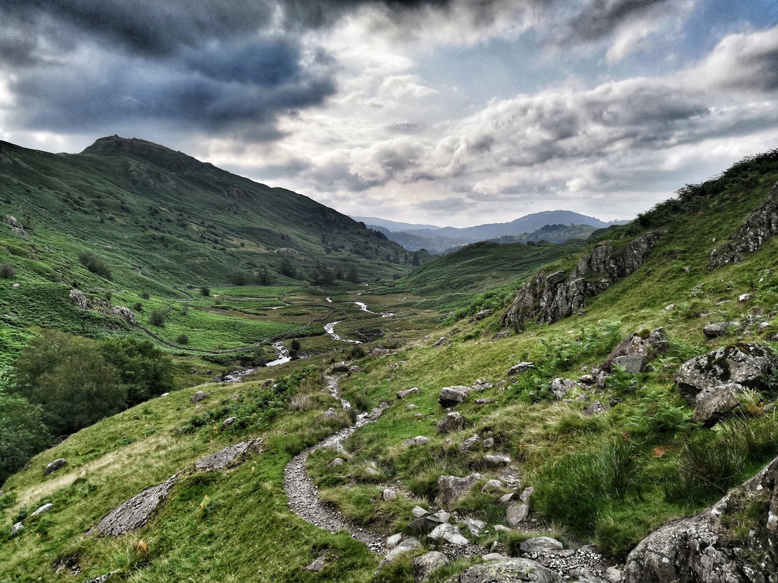
This mostly unmarked trail then continued through the Lake District, a real gem! Despite a lot of rain this stretch was a real highlight and I could not take enough pictures. Unfortunately, in on of the most beautiful places I got so soaked in a cloud burst that I could hardly take any pictures any more. The touchscreen of my smartphone was wet and I did not have any dry cloth to clean it. Plus my fingers were so wet and frozen ... It was still a wonderful day despite the fact that I had to put on soaking wet and cold clothes the following morning. I rewarded myself with a breakfast of champions outside the little supermarket in Grasmere and ate an entire package of chocolate trifle.

Idyllic campsite with unexpected visitors
One night I arrived at a spectacular lake with no one else around. Apparantly this was a popular campsite and as wild camping is usually tolerated in this National Park I set up my tent at this fantastic site despite the fact that there was goose shit all around. I soon regretted this: In the middle of the night I heard some crackling noises right outside my tent and I just see some small animal runnig away. Closer inspection revealed that a fox had dragged a bag of nachos and my trash bag out of the front pocket of my backpack! It was too dark to see what had happened to both but in the morning I had to collect empty wrappers and used toilet paper that was lying around. The nachos of course were completely gone ... A British friend told me later that something similar had happened to him at the exact same spot.

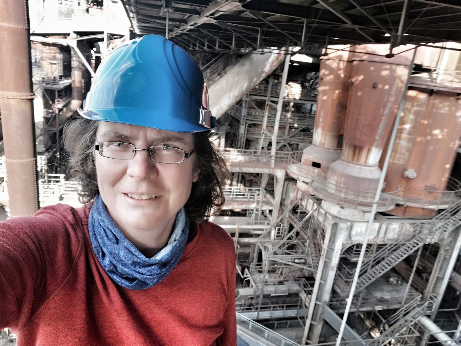
After a sort of connecting day I was in the Yorkshire Dales National Park and had reached the Pennines. More spectacular scenery, a lot of sheep and cattle - but unfortunately only chocolate brown drinking water that slightly tasted of iron but looked colorwise like peach ice tea. There were a lot of industrial remnants in this area which was a mining centre in the 18th and 19th  century. What looks almost like wilderness now was a busy industrial area once. Coast to Coast (C2C) is a popular trail and I came across several churches that offered drinks and snacks at cost price for hikers and there was even some trail magic boxes along the way. Very welcome in the rainy weather!

Drinking chocolate brown swamp water
One morning I was shocked to discover that my charging cable was gone with my phone only 20% charged up! A horror scenario for me whose smartphone is my backup navigational device. I found it half an hour later when packing 10 metres away. It had fallen out of my backpack when setting up the tent in the dark. I had my one and only rest day on the C2C in Richmond where I had booked myself into a rather posh B&B. The owner's husband was more than delighted by German native speaker because he had been forced to apply for a German tax number and could not figure out the application form. I ended up spending almost two hours translating and explaining it to him ... He rewarded my with a very substantial discount on the room price ...

Paragliders in the North York Moors
After another connecting day I arrived at North York Moors National Park where paragliders were taking advantage of the nice weather - which unfortunately turned very bad the next day. In fact so bad, that a lady walking her dog told me that even her dog did not want to go outside this day. I desperately tried to find some kind of accommodation for that night but every place I called was already fully booked. I was so distressed that I even went into a pub and ordered a cup of tea and something to eat. I was the first customer of the day and my backback left a huge puddle on the floor. Eventually I managed to find a room, but the landlady asked me: "When does your luggage arrive?" I had visions of my backpack walking on its own, but she just referred to the fact that most hikers have their luggage transported for them by commercial providers.

The place turned out to be a palace but unfortunately a very dusty one. She only rents out rooms occassionally and therefore the room really smelled as old as the house was. At least weather was a bit better on my last day when I reached the coast at Robin Hood's Bay. I had just reached the little village when I saw the bus rounding the corner - and even caught it. Therefore my hike on the C2C ended kind of abruptly ... Before I left Britain I met up with Colin, an old hiking friend of mine who gave me some new hiking ideas - as if I did not have enough of them already .... Then I had to return to Germany for a brief stint as a best woman at my best friend's wedding before resuming my hike.

Coast to Coast was the real highlight of this hike and I can highly recommend it!!!! I had hiked across Britain before from John O'Groats to Land's End and had not liked it a lot. With that experience I did not have high expectations for the Coast to Coast but I was literally overwhelmed by how great it was. One of the big advantages of the C2C is how easy wild camping is!!! It is tolerated in the three national parks and wasn't a problem in the connecting stretches in between. Although C2C is a popular trail I did not meet a lot of other hikers probably due to the fact that I had started on a Monday and mostly camped wheras most hikers stay in town.


Sunday, 6 October 2019

Europe Diagonal: Wicklow Way and conclusion for Ireland


The last stretch through Ireland was on the Wicklow Way, a rather popular Irish hiking trail. There were even Appalachian Trail shelters along the way. Good for me because in one of them I could score an almost full gas canister and batteries (although they turned out to be the worst quality ever!). Some boggy sections even had brand new board walks! By now I had gotten used to Irish weather which meant a faint drizzle every day. No wonder the island is so green. Luckily it never rained hard. Although the area is called Wicklow Mountains it was not very mountainous at all, just rolling hills with more forest than usual. Camping got easier. Biggest highlight of this sections was Glendalough, an old monastery which was now a major tourist attraction. I was a bit overwhelmed by the masses of people, many of them Americans searching for their emmigrant ancestors.

Glendalough in rain and mist
I fled quickly but was happy to meet Andrea and Mike for the last time and have a big celebratory dinner together. We all had steak and loved it! No wonder with all these happy cows on green meadows. I spent two more days in Dublin before taking the ferry over to Britain. This transit day to get to the start of my hike in the UK was more than stressfull. The ferry port in Dublin is so far outside that walking is almost impossible when catching an early morning ferry like me. And there is no bus at that hour which meant I had to take a taxi. Once in Britain there was construction work on the train line and of course everything was delayed. It took me seven hours and cost 125 Euro to cover a distance of 145 km ...

Beara Way
I had very much looked forward to hiking in Ireland as I had never been there before. I really liked the country: People were incredibly friendly and everyone was greeting me from their car when I was road walking. Prices were ok and I loved the buttery chocolate croissants! But hiking wise I was a bit disappointed. The Beara Way was nice with its coastal scenery, but the rest of my route through Ireland was ok, but definitely nothing to write home about. Almost 50% of the route were on concrete and there was very little forest. Still, stealth camping was not a big problem as Ireland is not densely populated. I'd say that Ireland is a nice hiking destination for beginners and I might come back one day to hike other trails, but it is not very high on my bucket list now. 

Saturday, 5 October 2019

Europe Diagonal: Ireland E8

Peat laid out for drying
Back on the trail I had to learn how to deal with Irish forest! First of all there is little of it because most of the land is used for cattle grazing. If there is forest, it consists mostly of impenetrable plantations that are covered with blackberry bushes around the edges to make things even worse. Finding discreet stealth campsites turned every evening into a nightmare. The trail was also not as nice as before: I was walking on small roads most of the time passing through rolling hills and moors where peat is still cut. When I discovered a brand new bike path along the river Suir which was even a bit shorter than the E8 I did not hesitate and walked it thus arriving a bit earlier in Carrick-on-Suir where I took a nero day.

With Andrea and Mike
I did not need it as urgently as I had thought! The day before I had caught up to Andrea and Mike
who were taking a nero day in Fermoy. They had invited my into their B&B to charge up my phone. In order to be not as smelly as usual I had even "bathed" in the river Blackwater before meeting them. Unfortunately this river is not called Blackwater for nothing. I was probably dirtier after bathing than before ... The owner of the B&B took pity on me and let me take a shower despite the fact that I was just visiting and not staying at his place. The three of us chatted so long that my empty powerbank was fully recharged by the time I left ...

Along the river Barrow
A couple of days I had another fabulous encounter. After resupplying in Craighuenamanagh (the town is really called that way) I was walking along the river Barrow, a really idyllic place with loads of paddlers in the water and ramblers on the former tow path. I had just passed two young women and had stopped to drink some water when they came walking back to me. To my utter surprise one of them asked my now in accent free German: "Are you Christine Thürmer?" It turned out that she was a German working here, had read one of my books and knew about my trip from social media. This is a small world and I loved chatting with the two Germans! I did not meet any other hikers on this stretch but one evening an older couple who told me: "We have already seen you this morning in our village, then we passed you in our car and now we see you walking here in the forest! You are such a brave woman!" I did not mention that I was about to look for a stealth campsite in the aforementioned forest .... And for once I found a great site immediately as soon as the two had disappeared.

Europe Diagonal: Ireland Beara Way

Dursey head
My trip started on July 3rd with several logistical complications. In Ireland I was following the European long-distance trail E8 which starts on Dursey Island in the Southwestern part of the country. But unfortunately, there is no public transportation going there! Getting there took me several days ... I flew into tiny Kerry airport with a direct flight from Berlin. Despite several low cost flights going there shuttle services to and from the airport are almost non-existent. I had pre-booked a taxi into nearby Killarney and was shocked to realize that I could hardly understand the taxi driver! Irish people do not speak the kind of English I was taught at school ... Killarney turned out to be a big tourist trap. Every other house was a B&B or restaurant. Luckily there were several outdoor stores, too where I could be a gas canister before embarking onto a bizarre bus ride to Castletownberee, the closest town to Dursey Island.

Inside the cable car
I had brought such a bad cough from Germany that the bus driver asked me if everything was ok with me ... I was more worried about the narrow and winding road that led to several emergency brakings. I was very happy to get off the bus and start hiking 20 km to Dursey Island! The real adventure was still to come because the island is connected with the mainland with Ireland's only cable-car, a construction that was built in 1969 and has a capacity of 6 passengers, 6 sheep or one cow. Cattle has priority over foot passengers ... The gondola is just fixed to one steel cable and crosses 350 meters over open sea. To calm down the passengers there is a bottle with Holy Water, a psalm and an intercom.

Once on the island I hurried to Dursey Head and the official start of my hike. I had even brought a
GoPro camera to record this moment. But when I tried to get it working the SD card was broken. I cursed modern technology and took some crappy pictures with my smartphone. Then I had to run back immediately to get the last ferry back. And this is when I first met Andrea and Mike who were also hiking across Ireland and had come by taxi .. We exchanged phone numbers and I hurried on. Being the only passenger in the tiny cabin was a bit scary. I had just caught the last ride. After all this rushing around I was rewarded with a wonderful sunset and a fabulous view over the sea from my campsite - although I was covered in fog the next morning in this exposed place.

I was now hiking the Beara Way, in hindsight the nicest part of my hike through Ireland. The sea was almost always in view but I was constantly crossing fences on stiles and had to worry about cows in fields though no bull attack happened. Still, I was a bit worried about getting bothered by aggressive or just curious cattle that I ended up camping in the ditch between two meadows one night - protected from visitors by barbed wire fences on both sides. Not the most comfortable campsite and I only chose it because the forecast had predicted a dry night - elsewise I would have been flooded! Next morning I rewarded myself with a hearty breakfast on a Lidl parking lot.

Butter shelf in an Irish Lidl - a lot of variety!
After only four days of hiking I took my first zero day in Cork. Not that I needed a zero day that early in my hike but my birthday was coming up and I wanted to celebrate it showered with clean clothes in a soft bed. Therefore I had booked myself into an AirB&B whose owner was a former bank executive and excelled in AirB&B as a second career now. She loved cleaning as I could see in the sparkling clean house where I was served wine and cake as a birthday gift. Cork itself was a bit disappointing but I loved the Butter Museum where I learnt everything about Ireland's famous export product (besides whiskey). I think they put double the amount of butter in Lidl chocolate croissants in Ireland than in Germany. I became addicted to Irish pastry!


Tuesday, 25 June 2019

Europe Diagonal: The idea

The idea of this hike is the result of a quick look at the map: I have already hiked across Europe from East to West and from North to North, which can be seen as a vertical and horizontal traverse of the continent. So what is next? A diagonal! Ireland to Greece!


I liked the idea immediately because the route crosses two countries I have not hiked in before but always wanted to: Irland and Greece. When I then did some prelimenary research about different route options I came across a trail in Belgium called GR 129 "Belgique en diagonal". I decided to regard this as a hint of fate and was set on the idea thereafter.

As there are two obstacles in the way - the Alps and some private and professional obligations - I will hike the route in two summer seasons: This year I will start early July in Ireland and hope to get as far as the Alps before snow starts falling and my publishing house is calling me back to my computer.

This year's route includes the following trails:
  • In Ireland I will follow the European long-distance trail E 8. I am really looking forward to this part as I have never been in Ireland before.
  • In Great Britain the E8 coincides with the Transpennine Way which is more of a biking and than hiking route. I therefore decided to cross the island a bit further North on Wainwright's classic Coast-to-Coast. As I have already hiked the length of Britain from John O'Groats to Land's End I thought that this time an East-West-traverse is enough ...
  • In Belgium I will follow the GR 129 which is so aptly named "Belgique en diagonal" - another part I am really looking forward to as I have done shorter hikes in Belgium before and really liked this underestimated hiking destination.
  • Luxembourg poses a bit of a problem as there is no decent hiking trail in the Southern part of this tiny country but I guess I will somehow work my way across the tiny country on local trails.
  • In Germany I wanted to use trails I have not done before - a bit difficult because I have already traversed my home country several times on foot. But I discovered some totally unknown routes like Saar-Mosel-Weg and Saar-Rhein-Weg and a diagonal traverse of the Black Forest on the HW5. From Lake Constance I will either take the popular Maximiliansweg or use some pilgrim routes - depending on how far winter has advanced. 
This first half of the European Diagonal is only 2,500 kilometres, the second half next year will be longer.