Monday, 5 September 2011

John O'Groats to Land's End: West Highland Way

Despite blisters and hurting feet I finally made it to Fort William, the Northern Terminus of the West Highland Way. I really had been counting days until I would get out of the mud and the wet socks and shoes onto the dry trails of the WHW! And it finally happened: On a sunny Saturday afternoon I finally arrived in Fort William. Of course, this being a bank holiday weekend I had been unable to find any accommodation there, but eventually this turned out to be a good thing.

Boat on the Caledonian Canal
The last bit before Fort Wiliam was a nice hike along the Caledonian Canal ending at the big lock at Neptun's staircase. And I could not believe my luck when I spotted free showers there!!!! Of course I could not pass this opportunity and even put on my last and only pair of dry socks for this occasion - and hiked into Fort William as a clean hiker! My first stop was at the local outdoor shop to buy another pair of socks... and of course do some resupply shopping. And to my big surprise there was a Lidl supermarket in Fort William - of course I ended up buying German chocolate there. But still I needed some sort of rest day soon - and everything seemed to be fully booked. On top of all that I had my one and only mail drop (new shoes and maps) in the next place on the WHW called Kinlochleven. I got a first sense of how crowded the WHW would be when I tried to make a hostel reservation in Fort William or Kinlochleven and everything was fully booked for the next couple of days! But somehow I got lucky and managed to get the last camping cabin in a hotel with campsite and this turned out to be godsent. The weather turned nasty and incredibly windy that day while I was lying snug in my cosy little 18 £ cabin with a little heater. My feet started healing and I feeling better.

Old military road on the WHW
Still the WHW was some sort of a culture shock. In the 2 week in the Highlands I had barely met anyone - and on my first half-day on the WHW I met about 70 hikers! The WHW is really incredibly popular and big business. Hostels, B&B and campsites everywhere - and literally hundreds of hikers. More than half of them did not carry any bigger backpack because they were slackpacking. There are actually several companies offering luggage service for the WHW. And the other half were carrying way too much luggage with all sort of equipment dangling from their already overloaded backpacks. And of course half of the WHW hikers were German....

Why the WHW is so popular is a mystery to me: For Scottish standards the scenery is rather mediocre. The route is a very low one that does not give spectacular views. And almost all the way a very busy and very noisy highway, the A82 is very close to the trail so that you can never escape the traffic noise. There are so many other interesting, beautiful and scenic trails in the UK or in Europe and still thousand of people want to hike the WHW. And on top of all that all these masses of people try to be as crowded as possible when it comes to camping. There are tons of free wild campsites all along the way but I have hardly seen anyone camping there. Instead all the hikers congregate in pay campsites or official free campsites that are dirty and crowded.

Well, at least I had dry feet again and made some progress - and I only spent 4 days on the WHW anyways. But if you want some advice: Don't hike the WHW - there are much better trails out there.

Monday, 29 August 2011

John O'Groats to Land's End: Northern Scotland

Me at the start of the hike

My trip started turbulent enough. I was supposed to fly on a Tuesday morning and already a week earlier German air traffic controllers had been threatening to go on strike early next week - and that could be my Tuesday. And sure enough: Monday morning I read on the internet that a strike was scheduled for Tuesday 6 am to noon. Great! That was not only threatening my flight but all my onward travel connections, too. I started biting nails and watched the internet as the employer side went to court in an attempt to prevent the strike. When I went to bed Monday night I still did not know whether I would actually be flying the next morning. But when I got up Tuesday  morning things had improved: The strike had been adverted in the very last minute due to mediation and my Ryanair flight was even early!

Cliffs near John O'Groats
Everything went according to plan: I got my prebooked train ticket fromt the ticket machine in Edinburgh train station, my train was on time and even my internet youth hostel booking had worked out. I spend the next day in Inverness sightseeing in pouring rain - at least I did not have to walk through that crap weather.

And then on August 11th I started my hike with bright sunshine at John O'Groats. Little did I  know that this was to be the last sunshine for a very long time... But to already sum it up: My hike through Northern Scotland has been the worst hiking I have done in a very long time. I guess some of it is due to mistakes I made myself with planning:

 
Peat bogs
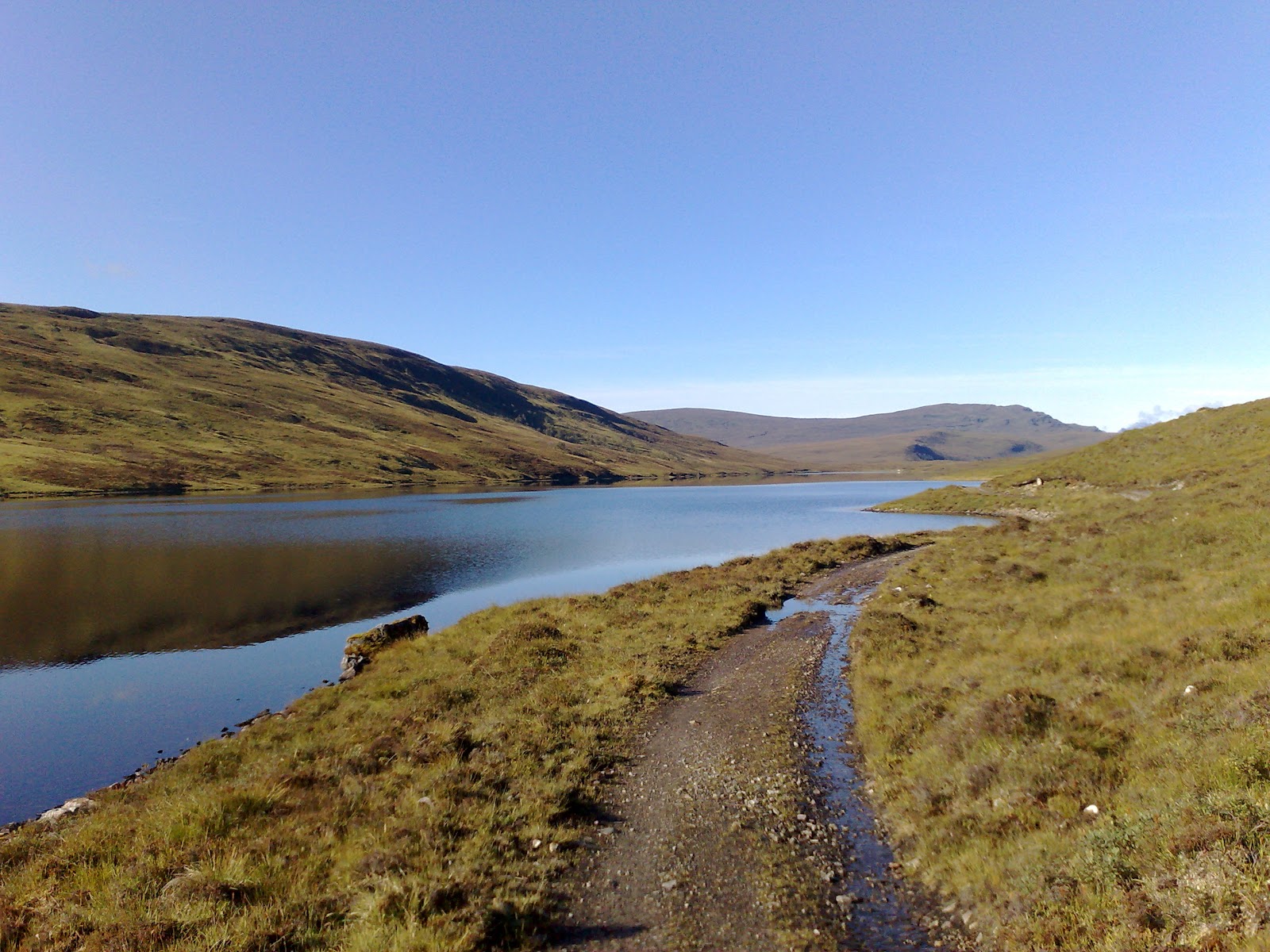
First of all I definitely underestimated the terrain. The sketch map of my Cicerone guidebook showed mostly pathes and trail and only about 15% cross country walking. I quickly realised that the cross country walking usually turned into a trip to hell. No matter where I went, the terrain was boggy, soggy and waterlogged. I was in mud up to my ankles and looked like a pig with dirt all over me. Even worse you could not usually tell beforehand how deep the mud would be. So often I just stepped onto what looked like solid ground and took a fall covering myself with more mud because it turned out a peat bog again. On top of all that the terrain got really steep and rocky (in between the muddy bits) once I was in the Highlands. My feet have not been dry for two weeks straight and started showing it. Not even on the Florida Trail have my feet been that bad. I had blisters and raw spots from rubbing all over my feet. Sometimes I just had to stop walking early because I could not stand the pain anymore. I usually average about 35 to 40 km per day, but on this stretch I was lucky to do 25 km....

Thousands of midges on my tent
Next big problem were the midges. I had known about them but I did not expect them to be that bad end of August. They were actually even worse than all the mosquitoes in Alaska!!!! There is a big difference between mosquitoes and midges: DEET works against mosquitoes, but does not seem to have much effect on midges. Mosquitoes are also relatively big - even if you get some in your tent you just kill them and then have a good night's sleep. But midges are so small  and they are so numerous that you actually breathe them in. They get everywhere and once inside your tent they are too many to kill them all. Things got so bad that I actually started cooking inside the tent - not in the vestibule, but inside the tent - something I have never done before. Packing things in the morning was a great logistical effort because you want to minimise your exposure to the midges as much as possible. It was difficult to even get a break, because I would be eaten alive by the midges as soon as I stopped moving. Therefore also no chance of airing my feet which did make my foot problems worse.

In hindsight another big problem was that I did not bring any overview maps. I just brought the Cicerone guide book sketch maps and the GPS. Unfortunately the GPS maps for Scotland were really bad and hardly showed any trails or tracks. Sometimes even roads were lacking. And therefore I could not make up alternative routes in order to avoid the dreaded cross country sections. In the end I was just counting days: Only 4 more days in this shit, only 3 more days and so on.

Bothy
There are some very nice bothies (shelters) in Scotland which are maintained by the MBA (Mountain Bothy Assosciation). But unfortunately, due to vandalism MBA has asked all map makers and guide book authors to remove the locations of their bothies!!!! So neither my guidebook nor any map showed the location of a bothy - I would just come across them by coincidence. I have great difficulty understanding this secret policy for bothies that can be a life saver in emergencies - if you know where they are!

Scotland can be nice...
After one week it was already apparent that I could not keep my schedule. Luckily I had met another long-distance hiker who had given me the OS map for that area and by that stroke of luck I was able to work out an alternative detour route through Ullapool. I urgently needed to resupply. I had started with 9 days worth of food but being already 2 days behind schedule I was running out. By another stroke of luck I was even able to get a reservation at the youth hostel there. Right now is tourist high season and everything seems to be fully booked all the time. And so I had a bit of well needed rest in Ullapool and could let my feet heal a day. Unfortunately, I had the worst fall of my whole trip in Ullapool - I slipped in the shower and fell right on my tail bone which is still hurting now 10 days later and makes it awkard to sit. But from Ullapool onward I started counting the days until I would reach Fort William, the West Highland Way and REAL trail again.

But things would get worse before they got better and that brings me to the last problem: the weather. The weather has not been very good (3 days of sun in 15 days) but not very bad either. It is drizzling most of the days but there are not too many torrential downpours. But it is much colder than I expected. One morning I woke up and found ice on my tent. And this was August 25th and the altitude only 300 meters....

To sum it up: Scotland is a place where I definitely do not want to hike again in the near future. And I find it hard to understand why Scotland is such a popular hiking destination especially for Germans. Yes, the landscape is very beautiful and remote, but you pay a very high price for that. And personally for me it has not been worth it. I would rather go to Scandinavia where you have similar landscape, but easier terrain and footing - and no midges!

But things are going to improve now: I have made it to Fort William and this means the start of the West Highland Way with hundreds of fellow hikers, decent trails and a shop around every corner. And soon I will be out of Scotland and on the Pennine Way which I have hiked before and really enjoyed. Things will only improve from now on...

Thursday, 4 August 2011

John O'Groats to Land's End: Planning

The biggest challenge in planning this trip has been to comb through the vast amount of information available for the different sections of this trip and condense it all down into a comprehensive and lightweight version.

There are two guidebooks on the market that feature the whole route - and hundreds of guidebooks and mapsets that cover sections of it. One of the "thruhiker guidebooks" by Andrew McCloy turned out to be rather useless. It contains only route descriptions without any actual maps. I was already starting to get discouraged by all the confusing route descriptions when I luckily came across the Cicerone guidebook by Andy Robinson "The end to end trail". This was exactly the kind of guidebook I had been looking for: It describes the whole route in good detail and gives sketch maps for the sections that are not part of a waymarked long-distance trail. It even gives overview information on shopping opportunities and accommodation. This book has proven to be invaluable in the planning process (I will almost completely follow its route suggestions) and will definitely be the main guidebook on trail.

Another invaluable online resource turned out to be the website of the Long-Distance Walkers Association. Their searchable data base does not only show all British long-distance trails on a map but also shows where they connect with each other. There is a lot of information for each trail and you can download gpx tracks for most of them. All the info is free, but you have to be a member (13 £) to download the tracks. (I found gpx tracks for all the trails I needed for free elsewhere on the net.)

I wanted to create a gpx track for the whole route and use the track together with maps on my GPS. So next I needed GPS maps for the UK. I was even willing to spend many on that, but everybody advised against the Garmin topo maps for the UK: Too much money for bad quality. There are a lot of other GPS maps for the UK on the market, but they were all for route planning only and could not be downloaded onto the GPS - and of course they were expensive, too. The solution came with Talkytoaster.info: Here you can download openstreetmap based maps for the UK - completely free! I was a bit afraid of the downloading process that sounded rather complicated, but it all worked fine. Mind you though that these maps are ok when following an existing gpx track, but they are by far not detailed enough for route planning of hiking trips.

Now I needed good online maps to map the missing sections based on the sketch maps in the Cicerone guidebook. The solution was www.grough.co.uk. Grough turned out to be a mixed blessing: First of all it is very cheap. 2 £ buy you one month of unlimited mapping using the wonderful Ordenance Survey maps and 40 pages of print outs. The map details are fantastic - 100% like your typical OS paper map and the printing is easy and renders high quality results. But grough is not the perfect solution either: First of all you can only use these maps online - you cannot download them onto your computer or your GPS. This means that everything takes forever. Theoretically you can upload existing gps tracks and print them out on the respective maps. Unfortunately, this did not work at all. Uploading tracks that had more than about 50 trackpoints led to constant time outs and system crashes. I got very frustrated and wasted entire days with this system until I realized that it is much faster to create the track in grough itself instead of unsuccessfully trying to import it. Still this process was very time-consuming, but less frustrating. Exporting tracks on the other hand worked quite well as long there were less than about 300 waypoints per track. I also used grough.co.uk to print out maps for the connecting stretches.

So now I will use my Garmin etrex GPS with OSM maps and a gpx track for the whole route. I have print out paper maps from grough.co.uk for the connector sections and will buy guidebooks or stripmaps for the established long-distance trails locally. I will carry the Cicerone guidebook that shows the connector sections  in sketch maps.and has route descriptions and town info. And last but not least I have an info sheet with all the logistical information on store hours, cheap hostels, gas canister availibility etc. that I have compiled myself with a lot of internet research.

A lot of work has gone into this project and I do hope it will pay off.

John O'Groats to Land's End: The Route

Next on my agenda is a hike through Great Britain, 2.000 km from John O'Groats in Northeast Scotland down to Land's End in Cornwall. Although this is the most popular hike across the UK, it is not a defined trail. Every hiker chooses their own route, but most link together existing long-distance pathes - and so will I. Most hikers walk from South to North (LEJoG), but I start rather late in the season and will therefore head the opposite direction (JoGLE). I would rather be in populated Southern England when the weather turns bad and the daylight hours dwindle than in Scotland - but that means that I will have to read all the guidebooks backwards! This is the route I have planned and it can be downloaded here in wikiloc:


These are the sections and long-distance pathes used:

  • Northern Scotland: John O'Groats to Fort William: This will be the technically most difficult stretch of the whole hike - right at the start. There are no existing long-distance trails and most of it will be cross-country. And to make matters worse there is only one little shop on day 8 of this stretch of 11 days. I will have to carry a lot of food!
  • Southern Scotland: Fort William to Jedburgh: At Fort William I will encounter the first established long-distance path of this trip, the West Highland Way. I have already hiked it, but that was in December 2003 - and hiking it in winter with only 7 hours of daylight had not been the smartest idea. I did not like it very much back then, but there aren't any good alternatives and so I will hope the WHW is better in summer. At the end of the WHW near Glasgow I come close to the most populated and industrialized are of whole Scotland - the corridor between Glasgow and Edinburgh. There is no really good way of covering this stretch so I opted for the Central Scottish Way that mostly follows canals on tow pathes - at least promising fast hiking on this rather unattractive stretch. Short stints on the Southern Upland and St Cuthberth's Way then take me to Jedburgh.
  • Pennines and Cheviots: Pennine Way: I am very much looking forward to this section as it is almost completely on the Pennine Way - one of my most favourite trails that I have already hiked in 2006. The Pennine Way seems incredible remote despite the fact that it is so close to the industrial heart of Britain.
  • From the Pennine Way to Wales: This has been the most difficult section for chosing a route. You have to circumnavigate a lot of very industrialized and populated areas and I chose a route that combines a lot of little-known but waymarked trails: Gritstone Trail, South Chesire Way and Maelor Way. 
  • Wales and Bristol Channel: I will next connect with Offa's Dyke Path which follows the Welsh border. Again, I have hiked parts of Offa's Dyke before, but this almost 10 years ago before I even knew that there is such a thing as ultralight long-distance hiking! Things get nasty after the end of Offa's Dyke: I have to cross the River Severn on a huge motorway bridge and then manouver around the urban sprawl of Bristol until finally meeting the South West Coast Path.
  • Cornwall: South West Coast Path: This last stretch takes me through Rosamunde Pilcher country - and hopefully some nice coastal walking. I have hiked parts of the SWCP before - end of November! Only God knows why I had chosen that miserable month. By the time I arrive in Cornwall it will be early to mid October and I do hope that the weather will be nicer than last time in November. Although the UK hike officially finishes at the appropriately named Land's End I will continue on past Penzance to see the famous St Michaels Mount which I think is a more spectacular ending than Land's End. 
Garmin Mapsource with which I planned this route tells me that my hike will be exactly 1.989 km long - and I expect to take a bit over 2 months. I am planning on doing a lot of sightseeing along the way and I have already purchased a National Trust Pass, allowing me to vist a lot of castles and monuments for free - and I am planning on taking advantage of it.

But you might wonder why I chose Great Britain? There are various reasons and one is a financial one: I always try "to hike with the exchange rate" and right now one currency that is even more desolate than the Euro is the British Pound. Great Britain has always been a very expensive country, but the exchange rate and couchsurfing will hopefully help me to save some money.

The other reason is that I always like to hike in countries that offer something unique - like the kangoroos and outback in Australia. Great Britain's nature is very unique: The Brits have already chopped down most of their forest back in the Stone Ages creating a very unique landscape with moors and exposed mountains. You either hate this sort of landscape and call it bleak or you love it and call it unique - I belong to the latter category of hikers. And of course there are all those castles, forts, gardens and mansions along the trail that are just waiting to be visited by me for free with my National Trust Pass.

And last but not least I love the British and their rather eccentric mentality. Nowhere else you find so much moulding carpets in bathrooms, so many complicated contraptions for just switching on a shower and such a love of purple plush sofa cushions. I love the old ladies that run B&B (not that I will be able and willing to afford many of them), the dry British humour that no German will probably find funny and the huge fully cooked breakfasts.

Monday, 1 August 2011

Denali National Park: Conclusion and Tipps

Mt McKinley massif
My usual question "Would I recommend this trip to a friend?" is difficult to answer in this case. I liked and hated Denali at the same time. I realised that this sort of crosscountry bushwhacking is definitely NOT my cup of tea. I just want to hike - and not bushwhack at 6 km per day! So for hiking I can definitely not recommend Denali. But on the other hand Denali was breathtakingly beautiful - if the weather permits you to see it! I have been very lucky because it was raining only 2 days during my 9 day stay. I was even able to see the famous Mt. McKinley, the highest mountain in the US between the clouds which is a rather rare, but spectacular event.

So my conclusion is: Yes, it is worth seeing Denali, but if you are not interesting in bushwhacking in alpine tundra I would not go out of my way to get there. If you are already in Alaska for whatever other reason, I would have a look at Denali through their bus system, maybe do a short 1 or 2 day hike, but I would not spend an extended period of time there.

Denali is a rather expensive adventure and here are some tricks on how to save money:

Savage River
There are various designated campgrounds all along the park road for which you have to make a reservation and pay a reservation and campground fee. You can easily avoid that by just getting a FREE backcountry permit for the surrounding backcountry unit. This way you only have to camp out of sight of the road and the camp ground which usually means just walking about 10 minutes. But you can still use the camp ground facilities like food stoarge locker, toilets and in some cases the running water. And you could even attend the nightly camp fire talks led by the park rangers which are really interesting.
View from Savage River

There is a free shuttle bus into the park as far as mile 15. If you want to go further you have to pay for the shuttle bus. Mile 15 gets you to Savage River campground, from where you can hike up the Savage River drainage which is a nice and relatively easy hike, as there are well used social trails. As described above you could camp close to the official campground for free in the backcountry unit. This way you can hike and camp in Denali without having to pay anything!

Moose antler found in a creek
If you opt to go inside the park and do some serious hiking / bushwhacking stick to either broad river valleys or ridgeline walking. Anything else will just lead to even worse bushwhacking. Do not expect to do more than 10 miles per day. Bring old clothes and backpacks as you will probably tear things up in the thorny bushes. Bring all your food with you from either Anchorage or Fairbanks as stores inside the park are very expensive. If you unexpectedly run out of food inside the park check the food storages at the popular camp grounds. They all have free food shelves for leftovers and some are so well stocked that you can resupply several days out of there! Bring enough time and patience for the backcountry permit process - the whole procedure including video and safety talk will take at least 1 - 1,5 hour. Expect to wait at least 30 - 45 minutes in line before you can purchase your bus ticket for buses beyond mile 15. I know all this sounds really painful, but overall the system works very well - as long as you have enough time and patience.

Sunday, 31 July 2011

Denali National Park

Bus on park road
There are no long-distance trails in Denali NP. There are no long-distance trails in whole Alaska! If you want to go for a hike, it will be crosscountry. Denali NP is relatively expensive: I had to pay for the shuttle to get there and back (80$ one way), entrance fee into the NP (10$ for a hiker), and the shuttle bus inside the park (31$). At least backcountry camping permits were free. Despite the high costs I decided to go to Denali because it made logistics so much easier: All of Alaska is grizzly bear country and for overnight camping you have to secure your food. In Denali you get a bear canisters for the length of your stay for free. In Denali you can cache food in all the campgrounds along the park road - thus reducing your pack weight tremendously. Plus you can use the shuttle bus inside the park to go back and forth as much as you like - you still only pay once for a ticket.

Braided river
I had heard all sorts of bad stories about the tyranny of the backcountry rangers and their quota system. Whole of Denali is divided into several backcountry units and only a limited amount of hikers are permitted into each unit per day. Although the permit itself is free, you have to get into that quota, watch a bear safety video and have a personal safety talk with a ranger. To my big surprise getting the backcountry permit I wanted was not a problem at all. Hardly any quota was full and I could chose whatever I wanted. But then I made a big mistake: I had only 25 minutes left before the departure of my bus, but the bear safety video is 30 minutes! I asked whether I could skip the last 5 minutes of the video.... big mistake! The ranger nearly freaked out, took the remote control away from me and insisted on watching the whole damn thing, even watching the door to the video room so that I could not escape early. I could not believe that... luckily the ranger relented after another tantrum and let me go running after my bus, that was already about to leave the bus stop - I made it in the very last second. So much for the ranger tyranny....

I had permits for 3 different hikes in Denali, but I want to focus on the longest one - a five day hike- to give you an impression what hiking in Alaska is like. As I have mentioned before there are no long trails in Denali. If you don't want to constantly bushwhack through alpine tundra you have two options: Either you climp up over tree and brush line (4,000 ft at Denali) and walk along the ridges. Or you follow rivers and streams. I opted for the latter, because I was afraid that the exposed ridgeline option could turn pretty nasty in bad weather.

Toklat River valley
The bus takes over 5 hours to get from the park entrance all the way along the park road (81 miles) to the end at Wonder Lake. My first hike started about in the middle at Toklat River - a huge wide glaciated river bed that I followed north for 2 days. This section of the hike was actually pretty easy for Denali standards. Although the river bed itself is almost 1 km wide, the stream itself is very small and braided in summer. It is not a big problem to walk on gravel bars, although you still have to cross the various streams occassionally - which have a strong current and can be up to waist high. Still, finding a suitable flat spot is not too difficult, albeit a bit time consuming. You have great visibility along the barren river bed - meaning you could see bears and other wildlife early enough to avoid it. But I did not see any bears in that section and only the occasional foot print. Weather was fantastic and the views great - I really enjoyed myself.

Clearwater Creek
The trouble started when I had to turn southward again this time following another drainage: Clearwater Creek. Clearwater Creek did indeed have very clear, but also very swift and deep water- and unfortunately was single channel, too. It was impossible to cross it in the beginning.Unfortunately it was surrounded by almost inpenetrable thick brush and sometimes even high cliffs. As it was impossible to walk in the swift water I had to fight my way through the brush always expecting to rip my clothes or backpack apart. Of course there were thousands of mosquitoes that made my life miserable. Things got especially bad when the river took a turn and on my side high cliffs turned up that I had to climb up and down. Going was incredibly slow as I had to move on arctic tundra which means layers and layers of thick moss interspersed with holes and thick brush. I was constantly afraid of stepping into one of these holes and spraining my ankle. To make things even worse I had to keep singing and speaking in order to make myself known to the bears - despite the fact that I was already huffing and puffing from the strenous walking.

After 10 hours of straight hiking (well, you can't really call it hiking - bushwhacking would be more appropriate) I had managed to advance less than 10 km and was totally exhausted. I was shaking from exhaustion. Eventually I had been able to cross the river, but these crossing were always iffy. As a rule of thumb you can cross very swift water as long as it is only knee deep. Usually you can still cross water levels that are a bit higher, but it takes a lot of effort and concentration. Clearwater Creek by now was up to mid-thigh, and although the crossing was now manageable - there were too many of them. I had to cross almost every 300 meters and the effort just drained my energy. I slept fitfully and had nightmares of not being able to get out of this mess. If the terrain did not improve, I would not be able to make it out to the park road before my food ran out.

Stony Creek
Luckily, the next day things improved tremendously. Clearwater Creek split into 2 different creeks and my side channel called Stony Creek started to braid almost immediately. River crossings got easier all the time and I made great progress. The weather stayed nice, too and my mood improved considerably - until I saw the huge amount of bear prints on the ground. There had been the occasional bear print before, but now they were all over the place. And for sure, it did not take another hour before I ran into my first grizzly bear in Denali. Just about 200 meters in front of me frolicking in the brush was a huge grizzly that had luckily not noticed me because the wind came from the other direction. I retreated immediately and pondered my options. The grizzly was feeding on berries along the river bank. I could not get around it on the right side, because there was the river with a steep high bank on the other side. But I did not dare to go around it on the left side either because it was all thick brush (possibly hiding bear cubs) and if the bear noticed me while I was on its left side it might panic because I was cutting off its escape route. I came to the conclusion that I could just wait till the bear moved on itself. Unfortunately, it took its time eating all those delicious berries. I sat there hiding for almost 45 minutes until the bear had disappeared.
Gorge narrowing down

I continued very carefully crossing onto the other side of the creek as soon as possible. Well, the bear had disappeared, but one hour later I stood right in front of a huge moose. Moose are no predators, but still more people die from moose than from bear attacks. And this particular moose seemed to be pretty deaf, because no matter what I yelled at it it would not move. It only ran away when I started moving towards it. I had less than 3 km to the park road but my problems were not over yet. I had to go through a narrow gorge first and a huge rockslide had gone down there a couple of years before. Instead of walking through tundra I had to rockclimb now. I thought I would never make it out to the road - but eventually I did!

Anchorage

Era airline plane
The flight back from Kaltag on the Yukon to Anchorage could have been really nice- if it had not been forced upon me under these unpleasant circumstances. Kaltag is a little native community with about 150 people. There are no roads to Kaltag and the only means of transport is either boat or plane. The only way to get to Anchorage was by plane and I booked that flight immediately after arriving. You book over the phone, but you can either pay by credit card or in cash. Almost all the airstrips in these little communities are pure dirt. We were given a ride to the airstrip by the local airline agent who is collecting and delivering cargo to the plane as well. The plane was tiny and the pilot a spotty 20 year old with cheap sunglasses. He did everything from loading the cargo and our luggage to giving safety instructions ("Read the paper in front of you"). And off we went getting a last glimpse of the Yukon from above. I felt so sad about having to leave that I cried looking down on the river.

Yukon from above
We landed in Kaltag where we had paddled through several days before and changed into another plane. This time we were the only 2 passengers....The flight from Galena to Anchorage was much longer and the route left the Yukon immediately - so no more nice views. In Anchorage I had another challenge to master and that was going through immigration. We had only done the immigration process over the phone in Eagle and still needed stamps in our passports. I had anticipated big problems with immigration since we had come into the US in a very unusual way - but the officers were incredibly friendly and gave us no trouble.

Pike - the Iditarod dog
Adrian's premature bail out had been unexpected and therefore I had had no time to plan what to do next. I was also still under shock from the events and felt mentally paralyzed. Luckily I had arranged earlier to stay with Matias, a friend of Triple Crowner Skittles.When I had called Matias from Kaltag he had luckily agreed to take me in earlier and even picked me up from the airport. I must have been a mess these first days. I still had to digest the unhappy events, change all my travel plans and come up with what to do in my last days in Alaska. Matias lives in a wood cabin in the mountains around Anchorage with 2 huskies, electricity, but no running water. I loved the place - and the dogs. One turned out to be a real celebrity: He had participated in the famous Iditarod race. I was thrilled! So, after 2 nights at Matias' place I had changed my flights and made up some plans for Alaska: I was going to hike in Denali National Park.